MyTopo
Buckskin Basin Idaho US Topo Map
Couldn't load pickup availability
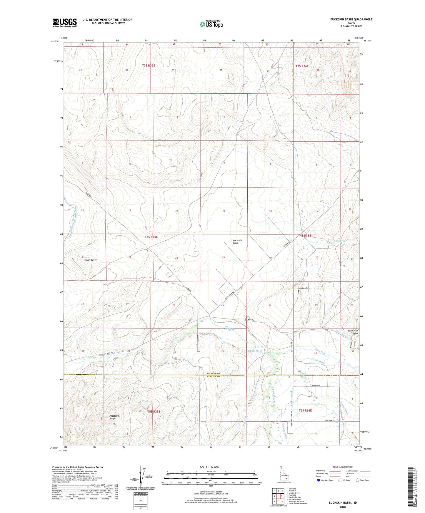
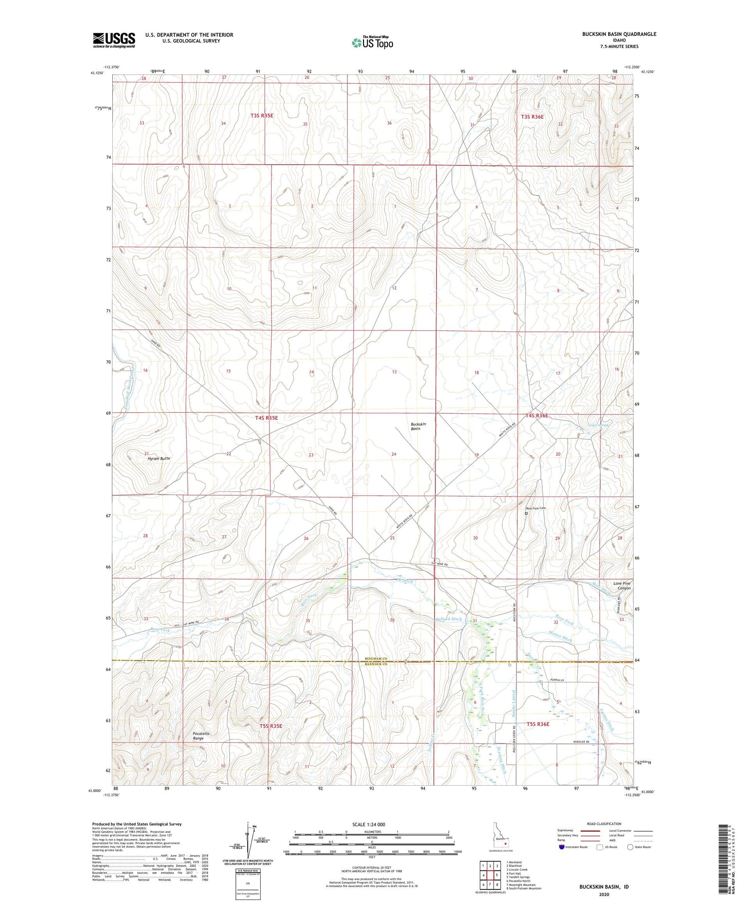
2023 topographic map quadrangle Buckskin Basin in the state of Idaho. Scale: 1:24000. Based on the newly updated USGS 7.5' US Topo map series, this map is in the following counties: Bingham, Bannock. The map contains contour data, water features, and other items you are used to seeing on USGS maps, but also has updated roads and other features. This is the next generation of topographic maps. Printed on high-quality waterproof paper with UV fade-resistant inks.
Quads adjacent to this one:
West: Fort Hall
Northwest: Moreland
North: Blackfoot
Northeast: Lincoln Creek
East: Yandell Springs
Southeast: South Putnam Mountain
South: Moonlight Mountain
Southwest: Pocatello North
This map covers the same area as the classic USGS quad with code o43112a3.
Contains the following named places: Ballard Ditch, Buckskin Basin, Cedar Spring, Farmer Creek, Farmer Ditch, Hyram Butte, Indian Creek, IR Ditch, Lone Pine Canyon, Metz Ditch, Putnam Lodge, Ross Fork, Ross Fork Cemetery, Ross Fork Indian School, South Fork Ross Fork, Wenee Ditch