MyTopo
Amboy Illinois US Topo Map
Couldn't load pickup availability
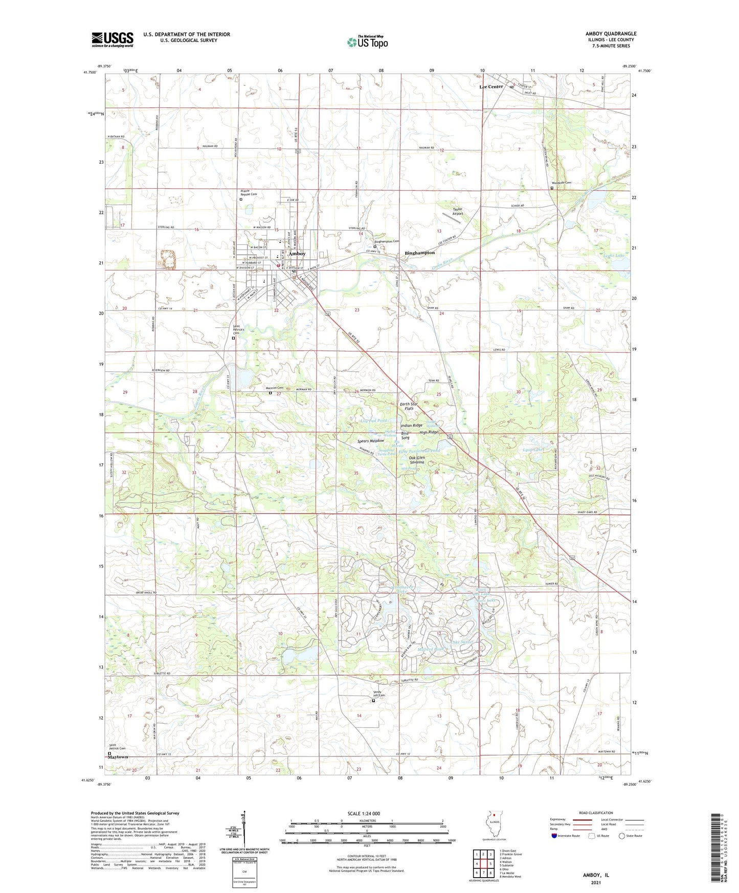
2024 topographic map quadrangle Amboy in the state of Illinois. Scale: 1:24000. Based on the newly updated USGS 7.5' US Topo map series, this map is in the following counties: Lee. The map contains contour data, water features, and other items you are used to seeing on USGS maps, but also has updated roads and other features. This is the next generation of topographic maps. Printed on high-quality waterproof paper with UV fade-resistant inks.
Quads adjacent to this one:
West: Walton
Northwest: Dixon East
North: Franklin Grove
Northeast: Ashton
East: Sublette
Southeast: Mendota West
South: La Moille
Southwest: Ohio
This map covers the same area as the classic USGS quad with code o41089f3.
Contains the following named places: Amboy, Amboy Central Elementary School, Amboy City Hall, Amboy Fire Protection District, Amboy High School, Amboy Junior High School, Amboy Marsh Sanctuary, Amboy Police Department, Amboy Post Office, Amboy Quarry, Bass Lake, Bass Lake Dam, Big Marsh, Binghampton, Binghampton Cemetery, Bird Song, Black Oak Lake, Earth Star Flats, Fifty Turtlehead Pond, First Baptist Church, High Ridge, Immanuel Lutheran Church, Indian Ridge, Indigo Wetland, Inlet Grove, Kessel Farms, Lake Sunset, Leake Lake, Lee Center, Lee Center Post Office, Lee County, Leffelman Airport, Lily Pad Pond, Lyon Lakes, Mallard Pond, Maytown, Meusel Farms, Mormon Cemetery, Oak Glen Savanna, Orchid Wetland, Pankhurst Memorial Library, Prairie Repose Cemetery, Saint Patrick Cemetery, Saint Patrick's Cemetery, Saint Patricks Church, Sandy Hill Cemetery, Schaver Farms, Setchell Farms, Shelburn, Snapping Turtle Pond, Spears Meadow, Taylor Airport, Township of Amboy, Township of May, United First Church, Wet Pond, Woodhaven Lake, Woodhaven Lake Dam, Woodpecker Woods, Woodside Cemetery, ZIP Codes: 61310, 61331