MyTopo
Ohio Illinois US Topo Map
Couldn't load pickup availability
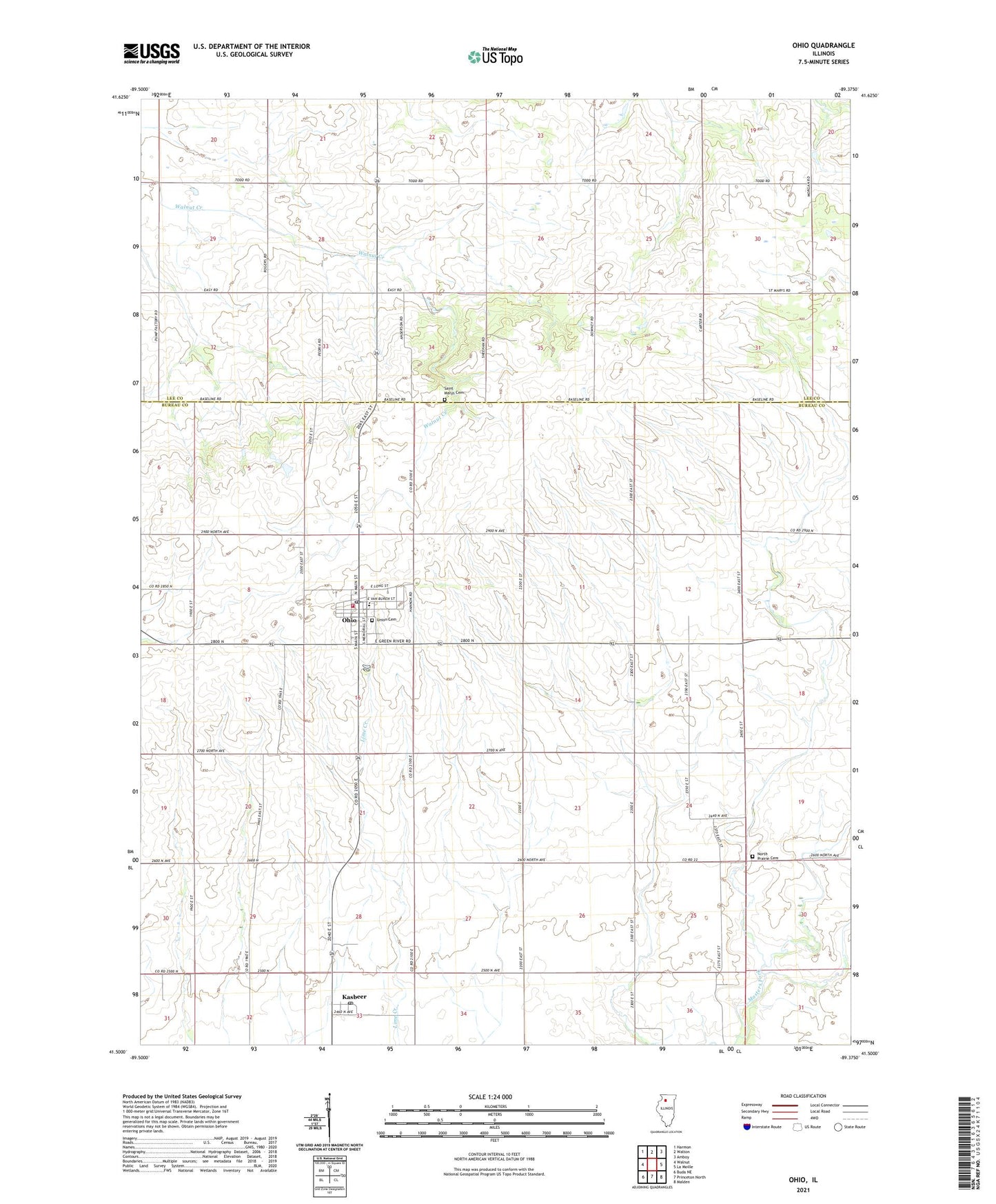
2024 topographic map quadrangle Ohio in the state of Illinois. Scale: 1:24000. Based on the newly updated USGS 7.5' US Topo map series, this map is in the following counties: Bureau, Lee. The map contains contour data, water features, and other items you are used to seeing on USGS maps, but also has updated roads and other features. This is the next generation of topographic maps. Printed on high-quality waterproof paper with UV fade-resistant inks.
Quads adjacent to this one:
West: Walnut
Northwest: Harmon
North: Walton
Northeast: Amboy
East: La Moille
Southeast: Malden
South: Princeton North
Southwest: Buda NE
This map covers the same area as the classic USGS quad with code o41089e4.
Contains the following named places: Albrecht Airport, Armstrong School, Downey School, Franklin School, Immaculate Conception Roman Catholic Church, Kasbeer, Kasbeer Community Church, Kasbeer Post Office, North Prairie Cemetery, Ohio, Ohio Cemetery, Ohio Community Consolidated Grade School, Ohio Community High School, Ohio Fire Protection District, Ohio Post Office, Ohio Public Library, O'Neill School, Pleasant Valley School, Saint Marys Cemetery, Township of Ohio, Union Cemetery, Village of Ohio, Zea Mays Field, ZIP Code: 61349