MyTopo
Ames Illinois US Topo Map
Couldn't load pickup availability
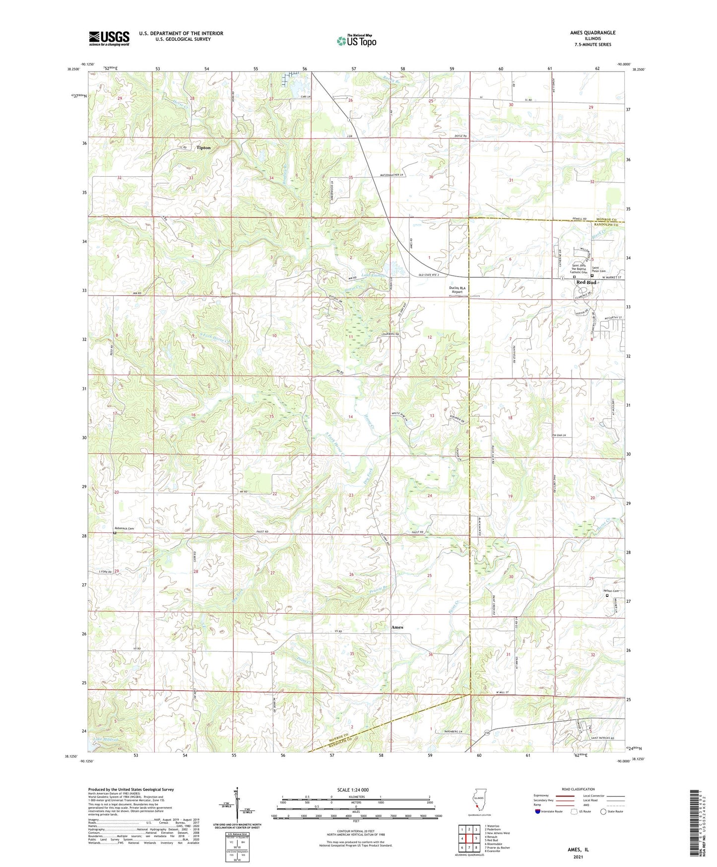
2024 topographic map quadrangle Ames in the state of Illinois. Scale: 1:24000. Based on the newly updated USGS 7.5' US Topo map series, this map is in the following counties: Monroe, Randolph. The map contains contour data, water features, and other items you are used to seeing on USGS maps, but also has updated roads and other features. This is the next generation of topographic maps. Printed on high-quality waterproof paper with UV fade-resistant inks.
Quads adjacent to this one:
West: Renault
Northwest: Waterloo
North: Paderborn
Northeast: New Athens West
East: Red Bud
Southeast: Evansville
South: Prairie du Rocher
Southwest: Bloomsdale
This map covers the same area as the classic USGS quad with code o38090b1.
Contains the following named places: Ames, Bradley Branch, Collier School, Dry Fork, Duclos RLA Airport, Earle School, Election Precinct 9, Illinois No Name Number 2020 Dam, Lake Emmett, Lake Emmett Dam, Lohrberg School, McBride School, McCuen School, Nelson Cemetery, O'Leary School, Our Lady Immaculata Airport, Paint Creek, Poe School, Prairie Branch, Rebenack Cemetery, Round Prairie School, Ruma Convent, Saint John the Baptist Catholic Cemetery, Saint Patrick School, Saint Peter Cemetery, South Fork Horse Creek, Tipton, Tiptown Church, Village of Ruma, Yankeetown School