MyTopo
Renault Illinois US Topo Map
Couldn't load pickup availability
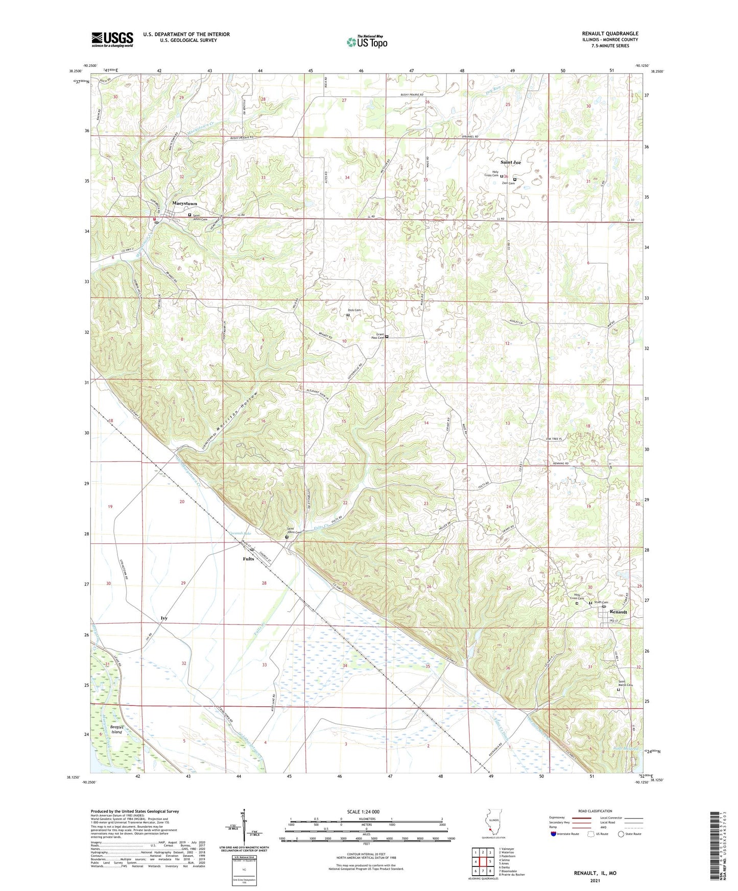
2024 topographic map quadrangle Renault in the state of Illinois. Scale: 1:24000. Based on the newly updated USGS 7.5' US Topo map series, this map is in the following counties: Monroe, Ste. Genevieve. The map contains contour data, water features, and other items you are used to seeing on USGS maps, but also has updated roads and other features. This is the next generation of topographic maps. Printed on high-quality waterproof paper with UV fade-resistant inks.
Quads adjacent to this one:
West: Selma
Northwest: Valmeyer
North: Waterloo
Northeast: Paderborn
East: Ames
Southeast: Prairie du Rocher
South: Bloomsdale
Southwest: Danby
Contains the following named places: Beagles Island, Bluff School, Cavanah Lake, Clifford School, Dick Cemetery, Election Precinct 13, Election Precinct 23, Fogelpole Cave Nature Preserve, Fults, Fults Creek, Fults Creek Ditch, Fults Hill Prairie Nature Preserve, Fults Post Office, Grant Pass Cemetery, Grant School, Holy Cross Cemetery, Illinois Caverns State Natural Area, Ivy, Kennif School, Lake Mildred, Lake Mildred Dam, Maeystown, Maeystown Historic District, Maeystown Post Office, Maeystown Volunteer Fire Department, Maus School, Morrison Hollow, Oak Grove School, Posten School, Renault, Renault Post Office, Renault Station, Saint Joe, Saint Johns Cemetery, Saint Marys Cemetery, Studt Cemetery, Village of Fults, Village of Maeystown, Wetzler Lake, Zion Cemetery, ZIP Codes: 62244, 62279