MyTopo
Armington Illinois US Topo Map
Couldn't load pickup availability
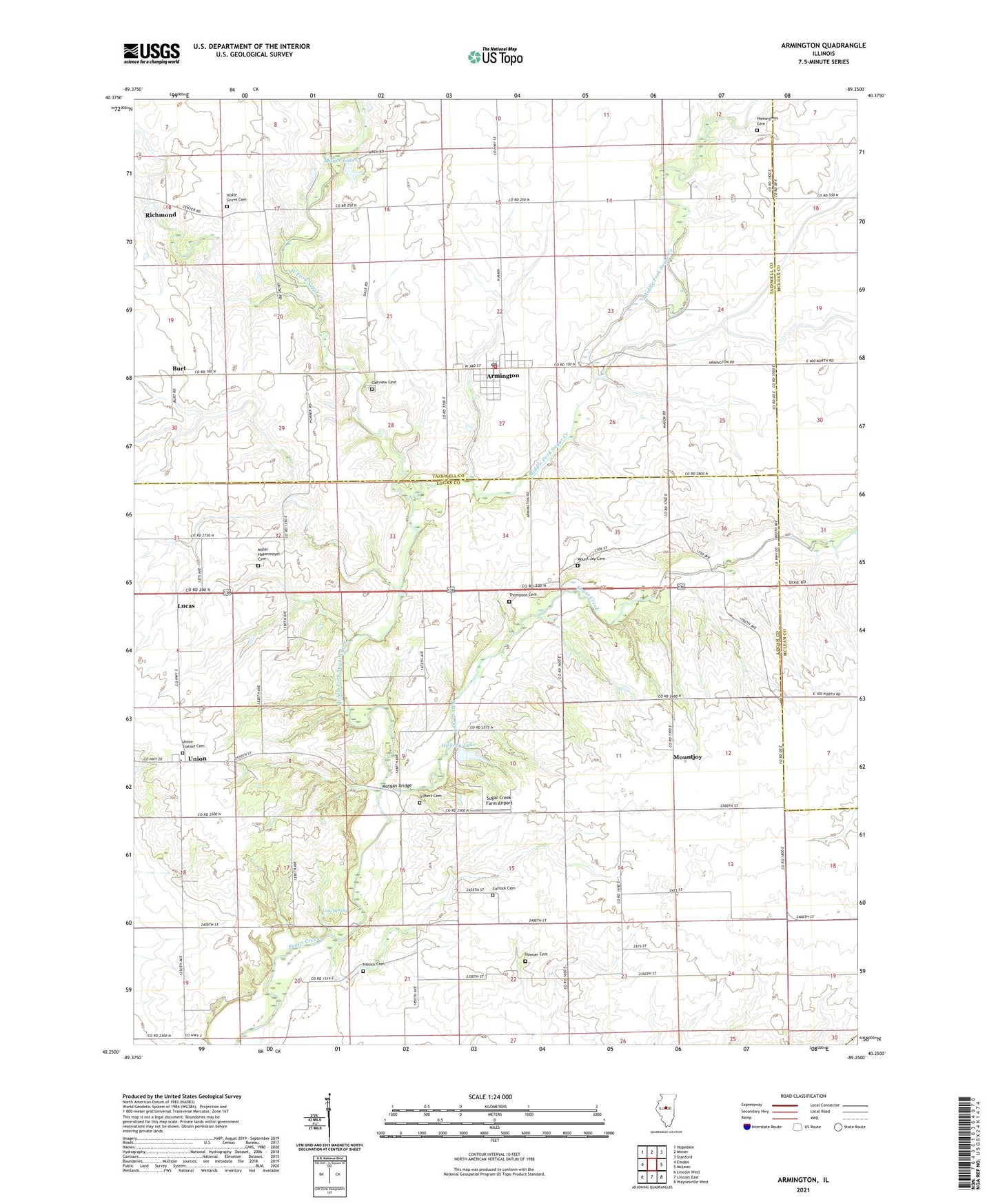
2024 topographic map quadrangle Armington in the state of Illinois. Scale: 1:24000. Based on the newly updated USGS 7.5' US Topo map series, this map is in the following counties: Logan, Tazewell, McLean. The map contains contour data, water features, and other items you are used to seeing on USGS maps, but also has updated roads and other features. This is the next generation of topographic maps. Printed on high-quality waterproof paper with UV fade-resistant inks.
Quads adjacent to this one:
West: Emden
Northwest: Hopedale
North: Minier
Northeast: Stanford
East: McLean
Southeast: Waynesville West
South: Lincoln East
Southwest: Lincoln West
This map covers the same area as the classic USGS quad with code o40089c3.
Contains the following named places: Armington, Armington Community Fire Protection District, Armington Post Office, Burt, Camp Griesheim, Carlock Cemetery, Dennis Lake, Dennis Lake Dam, Eminence Christian Church, Eminence Townhall, Feist Landing Strip, Gilbert Cemetery, Gold Spring, Hickory Lake, Hickory Lake Dam, Hieronymus Cemetery, Hittle Grove Cemetery, Howser Cemetery, Kingdom Hall, Lucas, Middle Fork Sugar Creek, Miller Hasenmeyer Cemetery, Minier Lake, Morgan Bridge, Mount Joy Cemetery, Mountjoy, Niblick Cemetery, Oakview Cemetery, Pleasant Hill School, Richmond, Sugar Creek Farm Airport, Thompson Cemetery, Township of Eminence, Township of Hittle, Union, Union Station Cemetery, Village of Armington, West Fork Sugar Creek, ZIP Codes: 61721, 61723