MyTopo
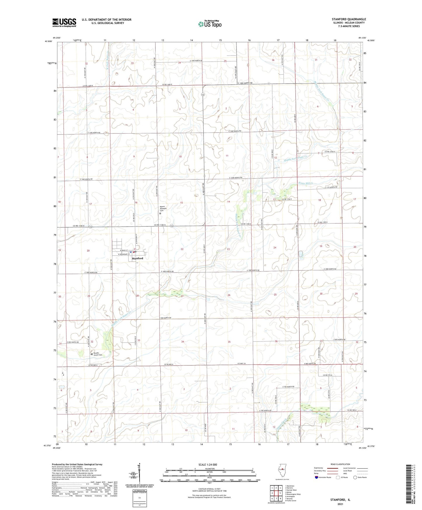
Stanford Illinois US Topo Map
Couldn't load pickup availability
2024 topographic map quadrangle Stanford in the state of Illinois. Scale: 1:24000. Based on the newly updated USGS 7.5' US Topo map series, this map is in the following counties: McLean. The map contains contour data, water features, and other items you are used to seeing on USGS maps, but also has updated roads and other features. This is the next generation of topographic maps. Printed on high-quality waterproof paper with UV fade-resistant inks.
Quads adjacent to this one:
West: Minier
Northwest: Mackinaw
North: Danvers
Northeast: Normal West
East: Bloomington West
Southeast: Funks Grove
South: McLean
Southwest: Armington
This map covers the same area as the classic USGS quad with code o40089d2.
Contains the following named places: Allin Township Ambulance, Allin Township Fire Protection District, Brooks Grove Cemetery, Covell School, Kings Mill Creek, Mount Pleasant Cemetery, Mount Pleasant Church, Olympia High School, Stanford, Stanford Grade School, Stanford Police Department, Stanford Post Office, Township of Allin, Village of Stanford, ZIP Code: 61774