MyTopo
Berryville Illinois US Topo Map
Couldn't load pickup availability
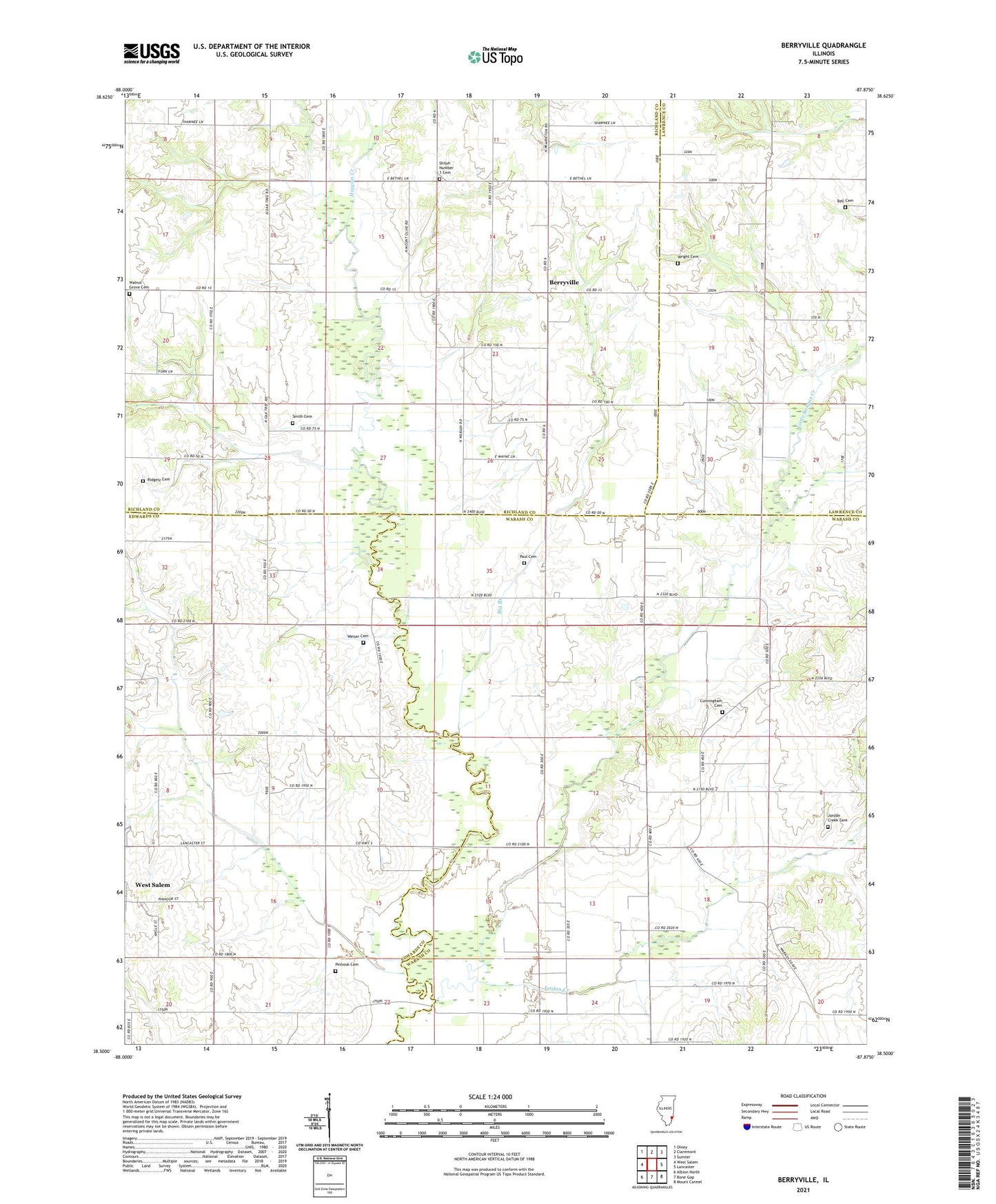
2024 topographic map quadrangle Berryville in the state of Illinois. Scale: 1:24000. Based on the newly updated USGS 7.5' US Topo map series, this map is in the following counties: Wabash, Richland, Edwards, Lawrence. The map contains contour data, water features, and other items you are used to seeing on USGS maps, but also has updated roads and other features. This is the next generation of topographic maps. Printed on high-quality waterproof paper with UV fade-resistant inks.
Quads adjacent to this one:
West: West Salem
Northwest: Olney
North: Claremont
Northeast: Sumner
East: Lancaster
Southeast: Mount Carmel
South: Bone Gap
Southwest: Albion North
This map covers the same area as the classic USGS quad with code o38087e8.
Contains the following named places: Bell Cemetery, Berryville, Big Branch, Buck Run, Burton School, Claremont - Bonpas Fire Protection District Station 2, Crooked Creek, Cunningham Cemetery, Gates School, Higgins Creek, Jordan Creek, Jordan Creek Cemetery, Lancaster Election Precinct, Little Bonpas Creek, Long Prairie School, Mills Prairie, Mills Prairie School, Mundy School, Paul Cemetery, Pinhook Cemetery, Pleasant Grove Church, Redhead School, Ridgely Cemetery, Salem Number 1 Election Precinct, Shiloh Number 1 Cemetery, Simmons Creek, Smith Cemetery, Township of Bonpas, Victory School, Walnut Grove Cemetery, Walnut Grove Church, Welser Cemetery, Whites School, Wright Cemetery, ZIP Code: 62419