MyTopo
Burnside Illinois US Topo Map
Couldn't load pickup availability
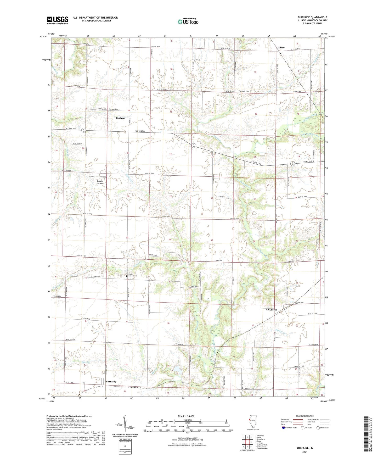
2024 topographic map quadrangle Burnside in the state of Illinois. Scale: 1:24000. Based on the newly updated USGS 7.5' US Topo map series, this map is in the following counties: Hancock. The map contains contour data, water features, and other items you are used to seeing on USGS maps, but also has updated roads and other features. This is the next generation of topographic maps. Printed on high-quality waterproof paper with UV fade-resistant inks.
Quads adjacent to this one:
West: Colusa
Northwest: Dallas City
North: Lomax
Northeast: Stronghurst
East: La Harpe
Southeast: Fountain Green
South: Carthage East
Southwest: Carthage West
This map covers the same area as the classic USGS quad with code o40091e1.
Contains the following named places: Alma Mater School, Bradshaw School, Burnside, Burnside Post Office, Disco, Douglas Airport, Durham, Durham Cemetery, Durham School, Fairview School, Forest Hill School, Grove Creek, Independence School, La Crosse, Liberty School, Madison School, McGuffy School, Pilot Grove Cemetery, Pilot Grove School, Pleasant Hill School, Shake Rag School, South Branch La Moine River, Spring Creek, Tilton School, Township of Durham, Township of Pilot Grove, Vandruff Cemetery, Victory School, Washington School, Wildcat Creek