MyTopo
Chana Illinois US Topo Map
Couldn't load pickup availability
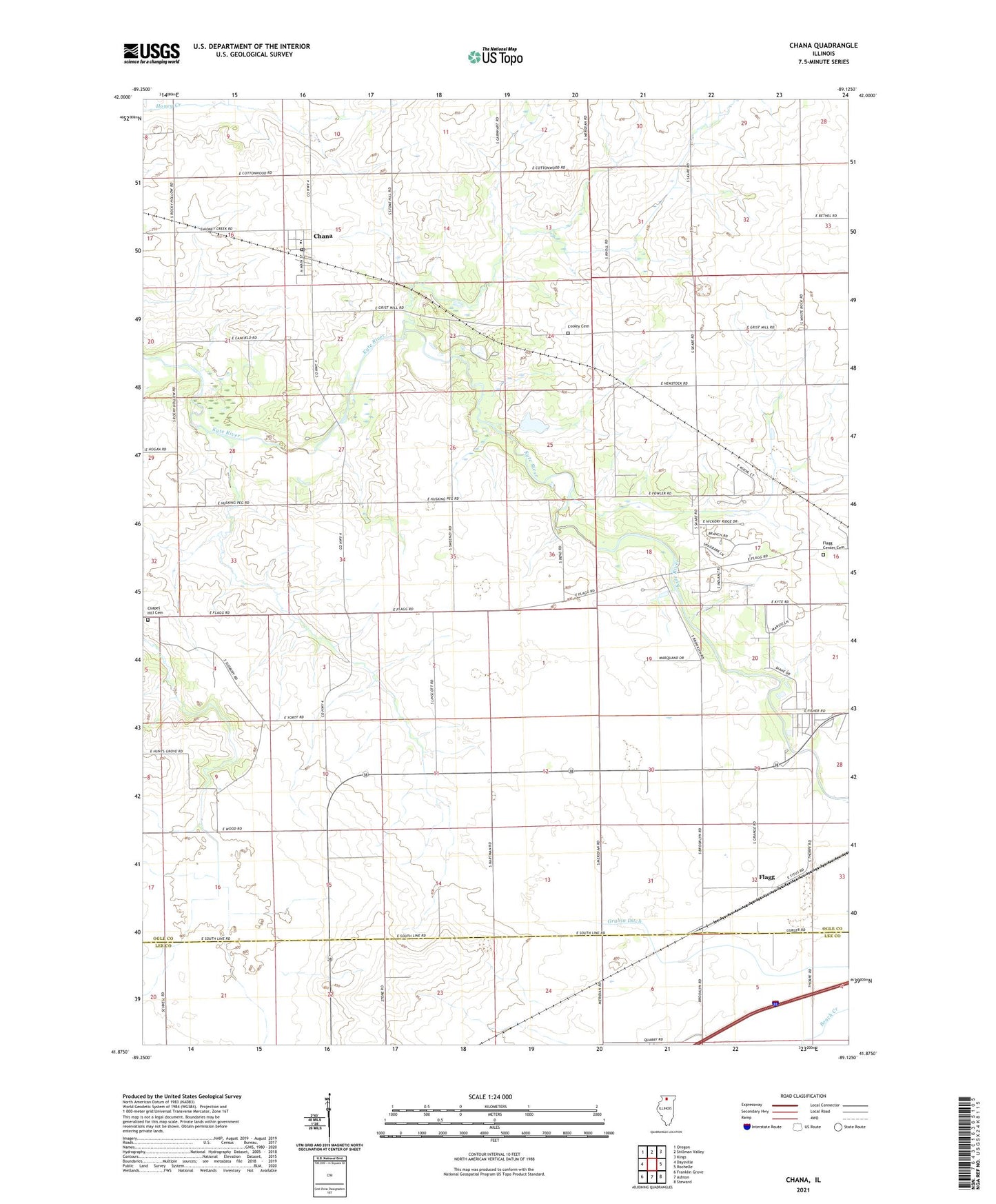
2024 topographic map quadrangle Chana in the state of Illinois. Scale: 1:24000. Based on the newly updated USGS 7.5' US Topo map series, this map is in the following counties: Ogle, Lee. The map contains contour data, water features, and other items you are used to seeing on USGS maps, but also has updated roads and other features. This is the next generation of topographic maps. Printed on high-quality waterproof paper with UV fade-resistant inks.
Quads adjacent to this one:
West: Daysville
Northwest: Oregon
North: Stillman Valley
Northeast: Kings
East: Rochelle
Southeast: Steward
South: Ashton
Southwest: Franklin Grove
This map covers the same area as the classic USGS quad with code o41089h2.
Contains the following named places: Antioch School, Ashton Church, Chana, Chana Post Office, Chana United Methodist Church, Chapel Hill Cemetery, Childers Acres, Cooley Cemetery, Crestwood Acres, Cyclone School, Fischer School, Flagg, Flagg Center Cemetery, Frahms Country Acres, Hemstock School, Hickory Ridge, Kyte Side Estates, Prairieview Estates, Reinke Airport, Skare Estates, Stonehill School, Township of Lafayette, Township of Pine Rock, Union School, Woodland Acres, Yorty School, ZIP Code: 61015