MyTopo
Steward Illinois US Topo Map
Couldn't load pickup availability
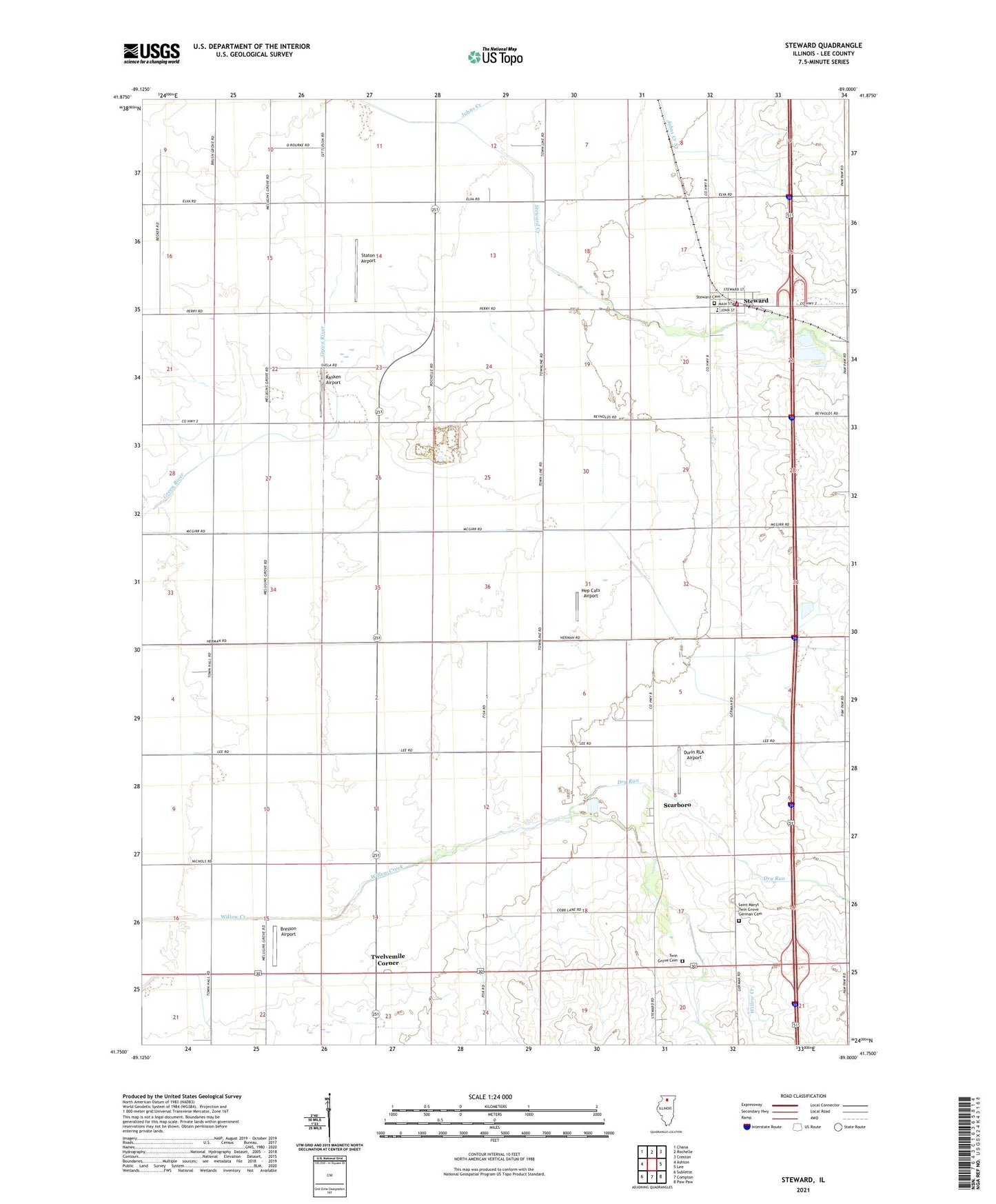
2024 topographic map quadrangle Steward in the state of Illinois. Scale: 1:24000. Based on the newly updated USGS 7.5' US Topo map series, this map is in the following counties: Lee. The map contains contour data, water features, and other items you are used to seeing on USGS maps, but also has updated roads and other features. This is the next generation of topographic maps. Printed on high-quality waterproof paper with UV fade-resistant inks.
Quads adjacent to this one:
West: Ashton
Northwest: Chana
North: Rochelle
Northeast: Creston
East: Lee
Southeast: Paw Paw
South: Compton
Southwest: Sublette
This map covers the same area as the classic USGS quad with code o41089g1.
Contains the following named places: Ackland Farm, Bresson Airport, Dry Run, Durin RLA Airport, Grimes School, Hep Cats Airport, Home Free Airport, Johns Creek, Journeysend Farm, Ogle - Lee Fire Protection District Steward Fire Department, Ranken Airport, Saint Marys Twin Grove German Cemetery, Scarboro, Staton Airport, Steward, Steward Cemetery, Steward Elementary School, Steward Post Office, Stoneridge Quarry, Svela Farms, Thompson Landing Strip, Township of Reynolds, Township of Viola, Twelvemile Corner, Twin Grove, Twin Grove Cemetery, Village of Steward, Webber School, Willow Creek, ZIP Code: 60553