MyTopo
Chrisman Illinois US Topo Map
Couldn't load pickup availability
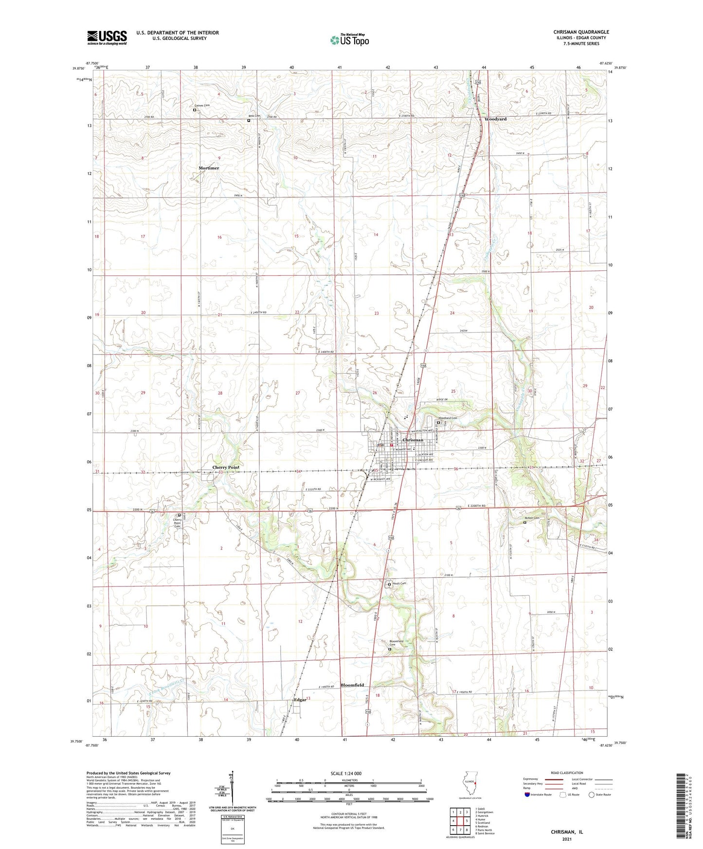
2024 topographic map quadrangle Chrisman in the state of Illinois. Scale: 1:24000. Based on the newly updated USGS 7.5' US Topo map series, this map is in the following counties: Edgar. The map contains contour data, water features, and other items you are used to seeing on USGS maps, but also has updated roads and other features. This is the next generation of topographic maps. Printed on high-quality waterproof paper with UV fade-resistant inks.
Quads adjacent to this one:
West: Hume
Northwest: Sidell
North: Georgetown
Northeast: Humrick
East: Scottland
Southeast: Saint Bernice
South: Paris North
Southwest: Redmon
This map covers the same area as the classic USGS quad with code o39087g6.
Contains the following named places: Bloomfield, Bloomfield Cemetery, Bloomfield School, Cherry Point, Cherry Point Cemetery, Chrisman, Chrisman Christian Church, Chrisman Elementary School, Chrisman Fire Protection District, Chrisman First Baptist Church, Chrisman High School, Chrisman Police Department, Chrisman Post Office, Chrisman United Methodist Church, City of Chrisman, Edgar, Gaines Cemetery, Hoult Cemetery, Legate School, Manning School, Maple Grove School, McKee Cemetery, Mitchell School, Mortimer, Mount Olive School, Northern Edgar County Ambulance Service, Prairie Union School, Rogers School, Ross Cemetery, Scotts, Township of Ross, Woodland Cemetery, Woodyard, ZIP Code: 61924