MyTopo
Paris North Illinois US Topo Map
Couldn't load pickup availability
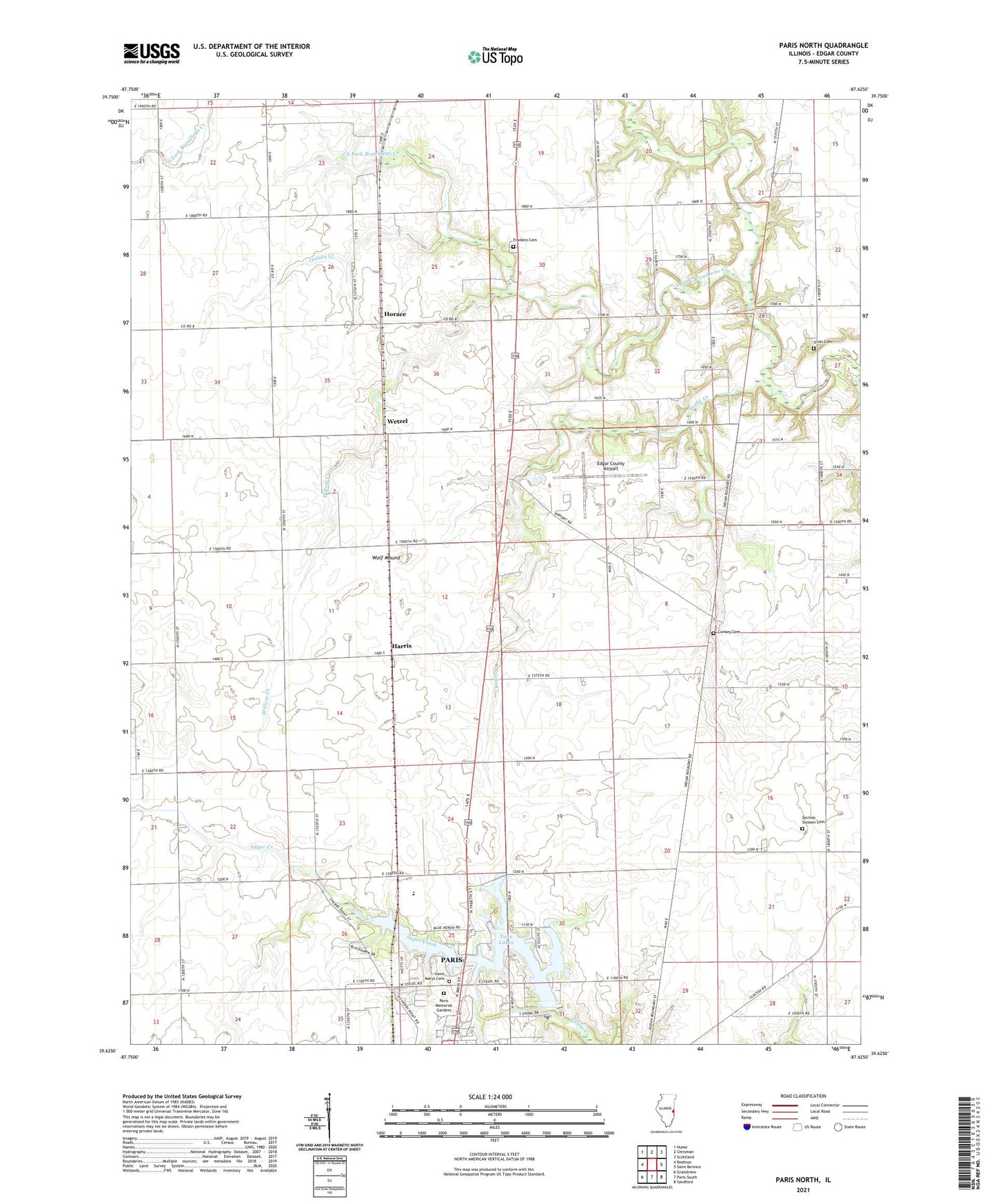
2024 topographic map quadrangle Paris North in the state of Illinois. Scale: 1:24000. Based on the newly updated USGS 7.5' US Topo map series, this map is in the following counties: Edgar. The map contains contour data, water features, and other items you are used to seeing on USGS maps, but also has updated roads and other features. This is the next generation of topographic maps. Printed on high-quality waterproof paper with UV fade-resistant inks.
Quads adjacent to this one:
West: Redmon
Northwest: Hume
North: Chrisman
Northeast: Scottland
East: Saint Bernice
Southeast: Sandford
South: Paris South
Southwest: Grandview
This map covers the same area as the classic USGS quad with code o39087f6.
Contains the following named places: Baldwinsville Post Office, Baldwinville School, Banner School, Camp Blackhawk, Conkey Cemetery, Edgar County, Edgar County Airport, Franklin Cemetery, Franklin Church, Harris, Horace, Indian Creek, Kimble School, Lanes Branch School, Larkin School, Mark School, Midway Landing Field, North Arm Church, North Arm Community Center, Paris Airport, Paris Memorial Gardens, Pine Grove Community Center, Pine Grove School, Plum Grove School, Saint Marys Cemetery, Scott Cemetery, Scott School, Section Sixteen Cemetery, Snake Creek, South Fork Brouilletts Creek, Sugar Creek School, Third Lake, Third Lake Dam, Township of Edgar, Township of Paris, Twin Lakes, Wetzel, Willow Creek, Wolf Mound