MyTopo
Grand Detour Illinois US Topo Map
Couldn't load pickup availability
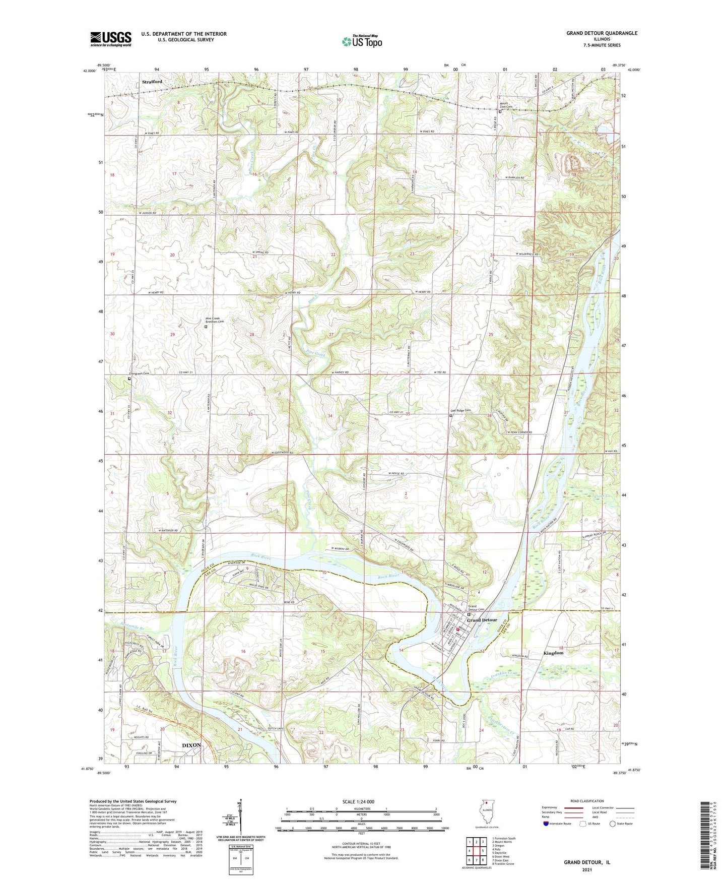
2024 topographic map quadrangle Grand Detour in the state of Illinois. Scale: 1:24000. Based on the newly updated USGS 7.5' US Topo map series, this map is in the following counties: Ogle, Lee. The map contains contour data, water features, and other items you are used to seeing on USGS maps, but also has updated roads and other features. This is the next generation of topographic maps. Printed on high-quality waterproof paper with UV fade-resistant inks.
Quads adjacent to this one:
West: Polo
Northwest: Forreston South
North: Mount Morris
Northeast: Oregon
East: Daysville
Southeast: Franklin Grove
South: Dixon East
Southwest: Dixon West
This map covers the same area as the classic USGS quad with code o41089h4.
Contains the following named places: Anterior School, Bend School, Blackhawk Camp, Camp Ralston, Cedar Ridge Campground, Center School, Chamberlain Creek, Clear Creek, Coffman Farm, Columbian School, Dixon Rural Fire Station 2, Evergreen Cemetery, Fairview School, Fox Canyon Campground, Franklin Creek, George B Fell Nature Preserve, Grand Detour, Grand Detour Cemetery, Grand Detour Census Designated Place, Grand Detour Sixth Grade Center, Harmony Hill School, Hazelwood School, Hickory School, Kingdom, Loughridge School, Lowell Park, Mount Zion Cemetery, Oak Ridge Cemetery, Oak Ridge School, Pennsylvania Corners, Pine Creek, Pine Creek Brethren Cemetery, Pine Creek Church, Pine Creek Quarry, Prairieside School, Rock River Bible Camp, Sevenmile Branch, Spring Creek Campground, Stratford, Sunny Crest Campground, The Pines, Township of Grand Detour, Township of Pine Creek, White Pines Forest Nature Preserve, White Pines Forest State Park