MyTopo
Polo Illinois US Topo Map
Couldn't load pickup availability
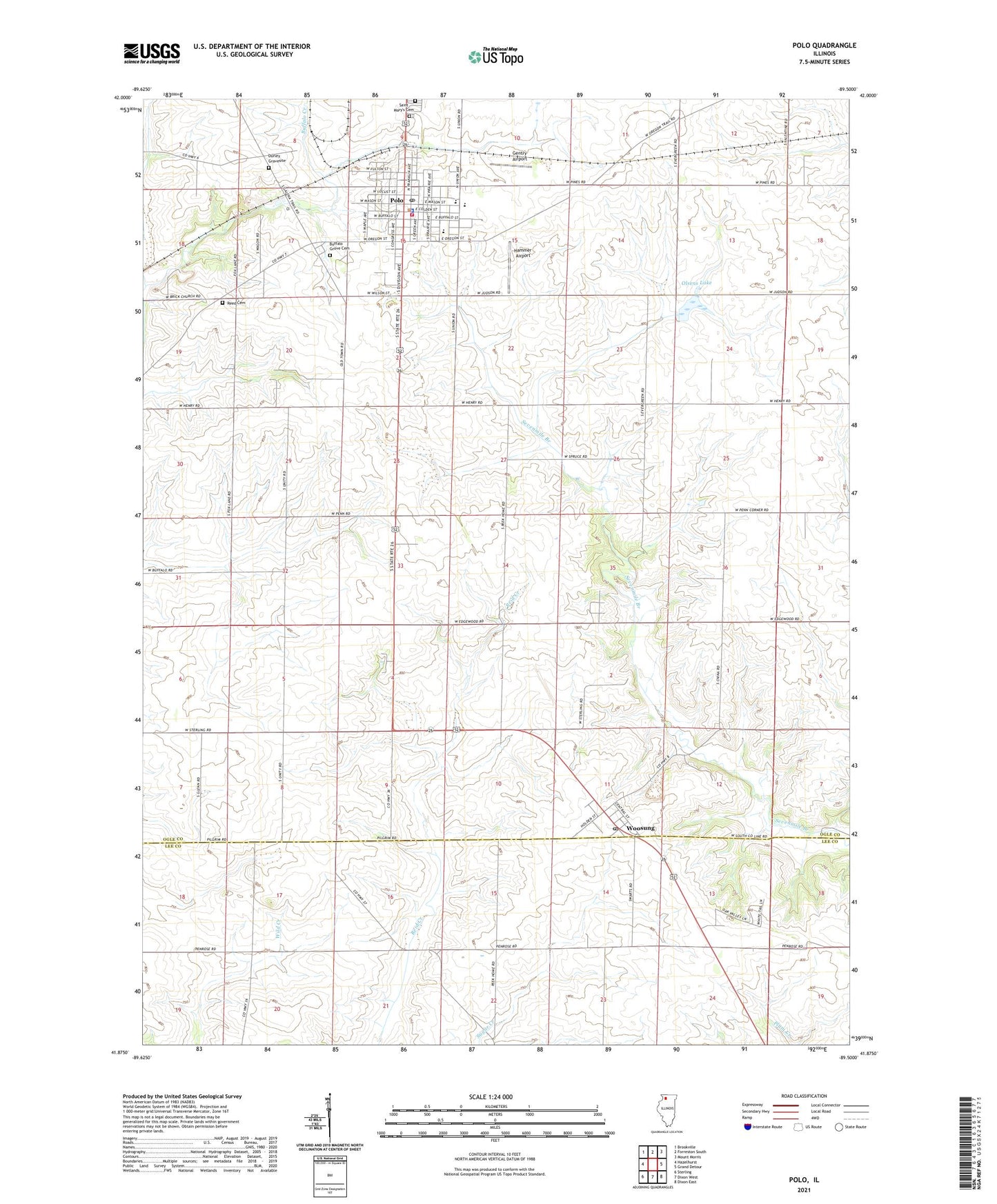
2024 topographic map quadrangle Polo in the state of Illinois. Scale: 1:24000. Based on the newly updated USGS 7.5' US Topo map series, this map is in the following counties: Ogle, Lee. The map contains contour data, water features, and other items you are used to seeing on USGS maps, but also has updated roads and other features. This is the next generation of topographic maps. Printed on high-quality waterproof paper with UV fade-resistant inks.
Quads adjacent to this one:
West: Hazelhurst
Northwest: Brookville
North: Forreston South
Northeast: Mount Morris
East: Grand Detour
Southeast: Dixon East
South: Dixon West
Southwest: Sterling
This map covers the same area as the classic USGS quad with code o41089h5.
Contains the following named places: Aplington School, Buffalo Grove, Buffalo Grove Cemetery, Buffalo Grove School, Buffalo Township Public Library, Centennial Elementary School, City of Polo, Community Church, Congress School, Cottage Hill School, Edgewood Golf Course, Emmanuel United Methodist Church, Evergreen School, Fairmount Cemetery, First Baptist Church, First Christian Church, Gentry Airport, Hammer Airport, Henry School, Judson School, Keator Park, Kemper Quarry, Moore School, Mound School, Olsens Lake, Olsens Lake Dam, Open Bible Church, Polo, Polo Church of the Brethren, Polo City Hall, Polo Community Ambulance Service, Polo Community High School, Polo Fire Protection District, Polo Police Department, Polo Post Office, Polo United Methodist Church, Polo Waste Water Plant, Reed Cemetery, Saint Marks Evangelical Lutheran Church, Saint Marys Catholic Church, Saint Mary's Cemetery, Township of Buffalo, Township of Woosung, Union School, Westside Park, WLLT-FM (Polo), Woosung, Woosung Post Office, ZIP Codes: 61064, 61091