MyTopo
Harristown Illinois US Topo Map
Couldn't load pickup availability
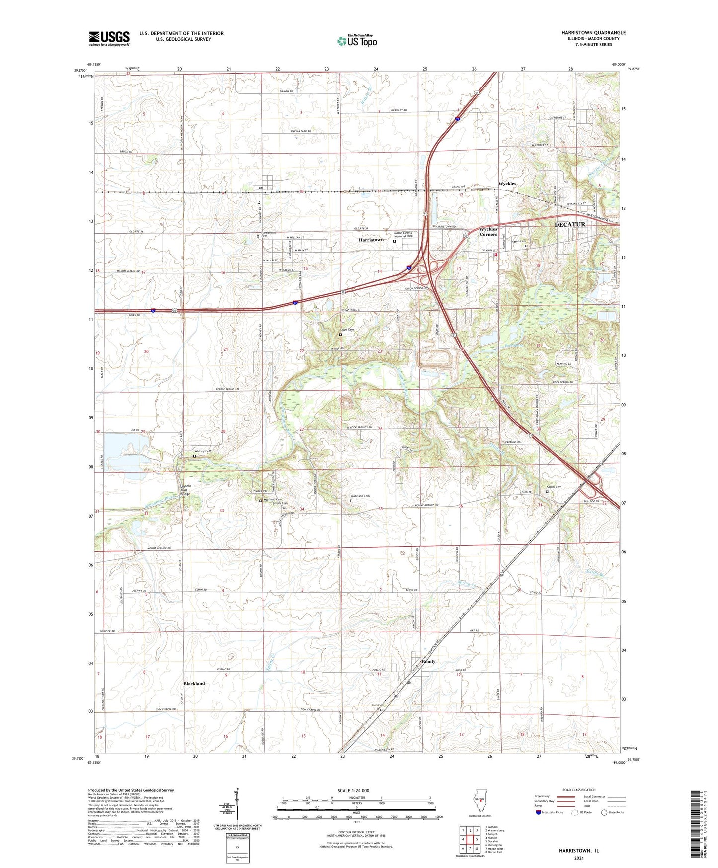
2024 topographic map quadrangle Harristown in the state of Illinois. Scale: 1:24000. Based on the newly updated USGS 7.5' US Topo map series, this map is in the following counties: Macon. The map contains contour data, water features, and other items you are used to seeing on USGS maps, but also has updated roads and other features. This is the next generation of topographic maps. Printed on high-quality waterproof paper with UV fade-resistant inks.
Quads adjacent to this one:
West: Niantic
Northwest: Latham
North: Warrensburg
Northeast: Forsyth
East: Decatur
Southeast: Macon East
South: Macon West
Southwest: Stonington
This map covers the same area as the classic USGS quad with code o39089g1.
Contains the following named places: Bethel Academy, Bethlehem Church, Blackland, Boody, Boody Census Designated Place, Boody Post Office, Brown Cemetery, Bulldog Crossing, Crum Cemetery, East Park Academy, Harristown, Harristown Cemetery, Harristown Christian Church, Harristown Elementary School, Harristown Fire Protection District, Harristown Post Office, Holiday Inn Heliport, Homestead Park, Hudelson Cemetery, Lincoln Trail Bridge, Lincoln Trail Homestead State Park, Macon County Memorial Park, Muirheid Cemetery, New Life Church, Rock Spring, Rock Springs Center, Salem Cemetery, Salem Church, Scovill Municipal Golf Course, Shady Lake, Sharon Cemetery, Sharon Church, Smiths Branch, Stevens Creek, Sunnyside Park, Sunnyside Road Church, Sunnyside School, Township of Blue Mound, Township of Harristown, Union Chapel, Union School, Village of Harristown, WDZ-AM (Decatur), Westfield School, Whitley Cemetery, Wyckles, Wyckles Corners, Zion Cemetery, Zion Chapel, ZIP Codes: 62514, 62522, 62537