MyTopo
Niantic Illinois US Topo Map
Couldn't load pickup availability
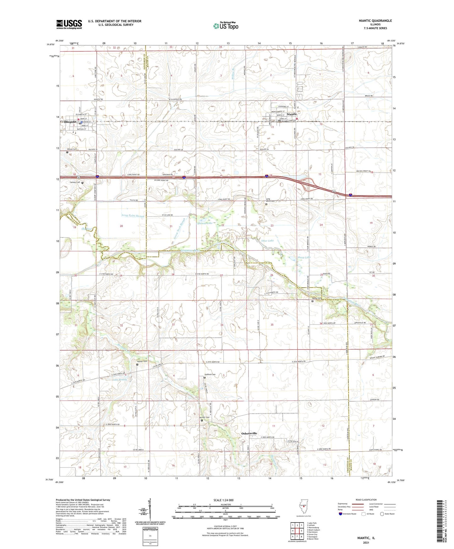
2024 topographic map quadrangle Niantic in the state of Illinois. Scale: 1:24000. Based on the newly updated USGS 7.5' US Topo map series, this map is in the following counties: Macon, Christian, Sangamon. The map contains contour data, water features, and other items you are used to seeing on USGS maps, but also has updated roads and other features. This is the next generation of topographic maps. Printed on high-quality waterproof paper with UV fade-resistant inks.
Quads adjacent to this one:
West: Mount Auburn
Northwest: Lake Fork
North: Latham
Northeast: Warrensburg
East: Harristown
Southeast: Macon West
South: Stonington
Southwest: Grove City
This map covers the same area as the classic USGS quad with code o39089g2.
Contains the following named places: Berea Cemetery, Berea Church, Calamus Lake, Calamus Lake Nature Preserve, Calvary Cemetery, Darmer Cemetery, Goose Neck Slough, Hunter Cemetery, Illiopolis, Illiopolis Fire Protection District, Illiopolis High School, Illiopolis Post Office, Illiopolis Village Police Department, Lake Waddy, Long Point Cemetery, Long Point Church, Long Point Slough, Niantic, Niantic Fire Protection District, Niantic Post Office, Niantic-Harristown High School, Osbernville, Osbernville Community Building, Otter Lake, Sheep Lake, Simmons Farm, Stafford Cemetery, Township of Mosquito, Township of Niantic, Village of Niantic, Wilcox Cemetery, Willow Branch, ZIP Codes: 62547, 62551