MyTopo
Hazelhurst Illinois US Topo Map
Couldn't load pickup availability
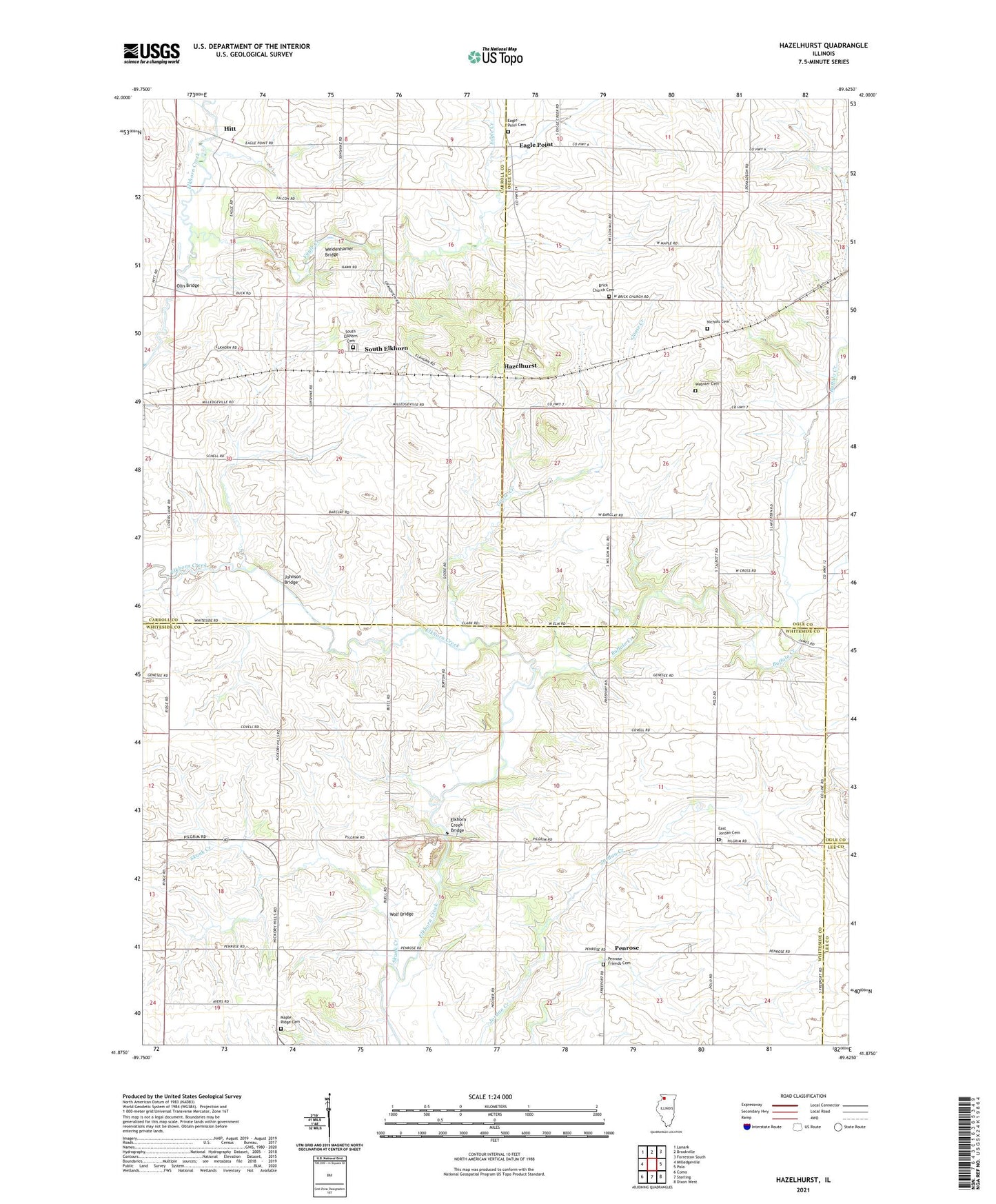
2024 topographic map quadrangle Hazelhurst in the state of Illinois. Scale: 1:24000. Based on the newly updated USGS 7.5' US Topo map series, this map is in the following counties: Whiteside, Carroll, Ogle, Lee. The map contains contour data, water features, and other items you are used to seeing on USGS maps, but also has updated roads and other features. This is the next generation of topographic maps. Printed on high-quality waterproof paper with UV fade-resistant inks.
Quads adjacent to this one:
West: Milledgeville
Northwest: Lanark
North: Brookville
Northeast: Forreston South
East: Polo
Southeast: Dixon West
South: Sterling
Southwest: Como
This map covers the same area as the classic USGS quad with code o41089h6.
Contains the following named places: Barcley School, Brick Church Cemetery, Buffalo Creek, Buffalo Creek Farms, Carter Siding, Compton School, Donaldson School, Doty School, Eagle Creek, Eagle Point, Eagle Point Cemetery, East Jordan Cemetery, East Jordan United Methodist Church, Elkhorn Church, Elkhorn Creek Bridge, Eller Quarry, Fairview School, Goose Creek, Gould School, Hazelhurst, Hitt, Hitt School, Johnson Bridge, Jordan Center, Jordan Church, Maple Ridge Cemetery, Nichols Cemetery, Olin Bridge, Paynter School, Penrose, Penrose Friends Cemetery, Sanfordville, Siers Quarry, Skunk Creek, South Elkhorn, South Elkhorn Cemetery, Talbott School, Township of Eagle Point, Township of Elkhorn Grove, Township of Jordan, Webster Cemetery, Weidenhamer Bridge, Wolf Bridge