MyTopo
Hillsdale Illinois US Topo Map
Couldn't load pickup availability
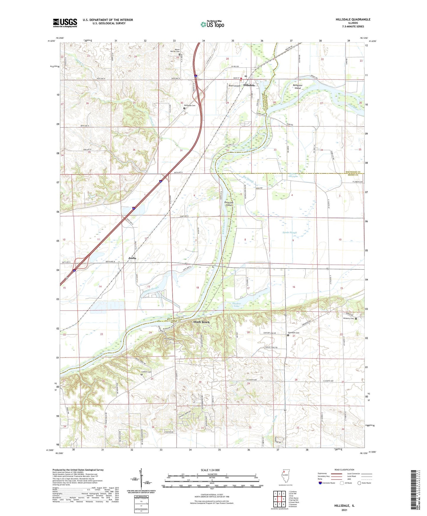
2024 topographic map quadrangle Hillsdale in the state of Illinois. Scale: 1:24000. Based on the newly updated USGS 7.5' US Topo map series, this map is in the following counties: Henry, Rock Island, Whiteside. The map contains contour data, water features, and other items you are used to seeing on USGS maps, but also has updated roads and other features. This is the next generation of topographic maps. Printed on high-quality waterproof paper with UV fade-resistant inks.
Quads adjacent to this one:
West: Port Byron
Northwest: Cordova
North: Erie NW
Northeast: Erie
East: Spring Hill
Southeast: Atkinson
South: Geneseo
Southwest: Green Rock
This map covers the same area as the classic USGS quad with code o41090e2.
Contains the following named places: Bethesda Cemetery, Big Slough, Black Airport, Canoe Creek, Colbert Cemetery, Ebenezer Cemetery, Ebenezer Community Church, Ebenezer School, Hillsdale, Hillsdale Fire Protection District, Hillsdale Post Office, Joslin, Joslin Census Designated Place, Joslin School, Joslin Slough, Kempster Island, Kempsterville School, McHenry Cemetery, Mount Moriah Cemetery, Oak Grove School, Oxbow Slough, Peterson Island, Phenix School, Poplar Grove School, Riverdale Junior High School, Ropp Airpark, Shadow Lake, Shady Beach, Spade Slough, Township of Canoe Creek, Township of Phenix, Village of Hillsdale, ZIP Code: 61257