MyTopo
Kewanee North Illinois US Topo Map
Couldn't load pickup availability
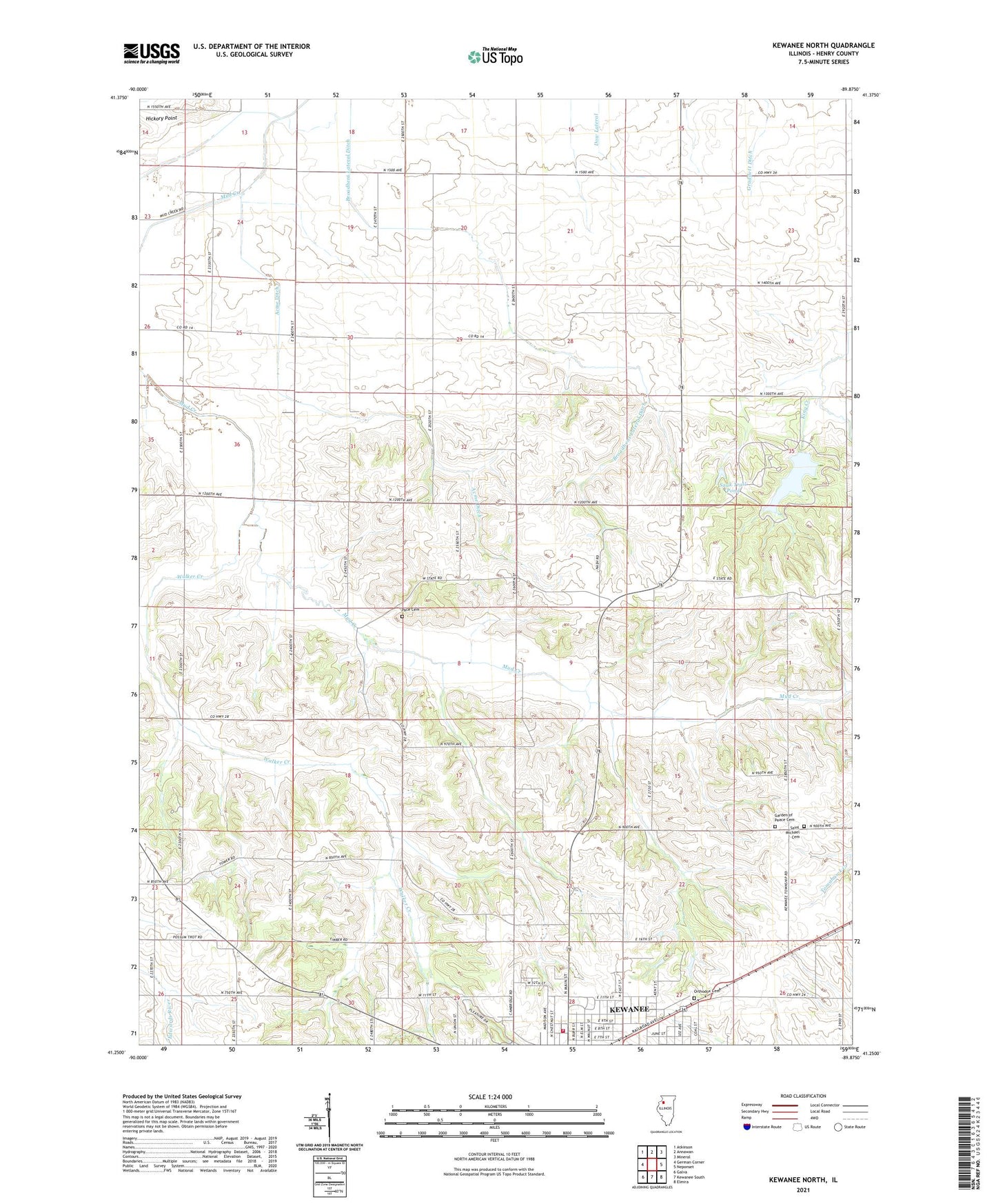
2024 topographic map quadrangle Kewanee North in the state of Illinois. Scale: 1:24000. Based on the newly updated USGS 7.5' US Topo map series, this map is in the following counties: Henry. The map contains contour data, water features, and other items you are used to seeing on USGS maps, but also has updated roads and other features. This is the next generation of topographic maps. Printed on high-quality waterproof paper with UV fade-resistant inks.
Quads adjacent to this one:
West: German Corner
Northwest: Atkinson
North: Annawan
Northeast: Mineral
East: Neponset
Southeast: Elmira
South: Kewanee South
Southwest: Galva
This map covers the same area as the classic USGS quad with code o41089c8.
Contains the following named places: Acme Ditch, Acme School, Baker Park, Beyer School, Blinn School, Bobtown School, Brandenburg Corners, Broadbent Lateral Ditch, Burns School, Chief Black Hawk Picnic Area, Chief Keokuk Campground, Chief Pontiac Picnic Area, Chief Shabbona Picnic Area, Chief Tecumseh Picnic Area, Church of Peace, Cosner School, Enslow School, Fairview Church, Garden of Peace Cemetery, Henning School, Hickory Point, Hold Ridge School, Huntville School, Illinois Youth Center - Kewanee, Johnson Lake, Johnson Sauk Trail Lake Dam, Johnson Sauk Trail State Park, Kewanee Community Fire Protection District, Kuster School, Lincoln School, Lyle Elementary School, Monroe School, Moon School, Northeast Park, Orthodox Cemetery, Pace Cemetery, Palmer School, Ryan Round Barn, Saint Michael Cemetery, Sauk Trail Pond, Singing Bird Picnic Area, Taylor School, The Prophets Picnic Area, Township of Annawan, Township of Kewanee, Union School, Walker Creek, Walker School, Weston School, ZIP Code: 61443