MyTopo
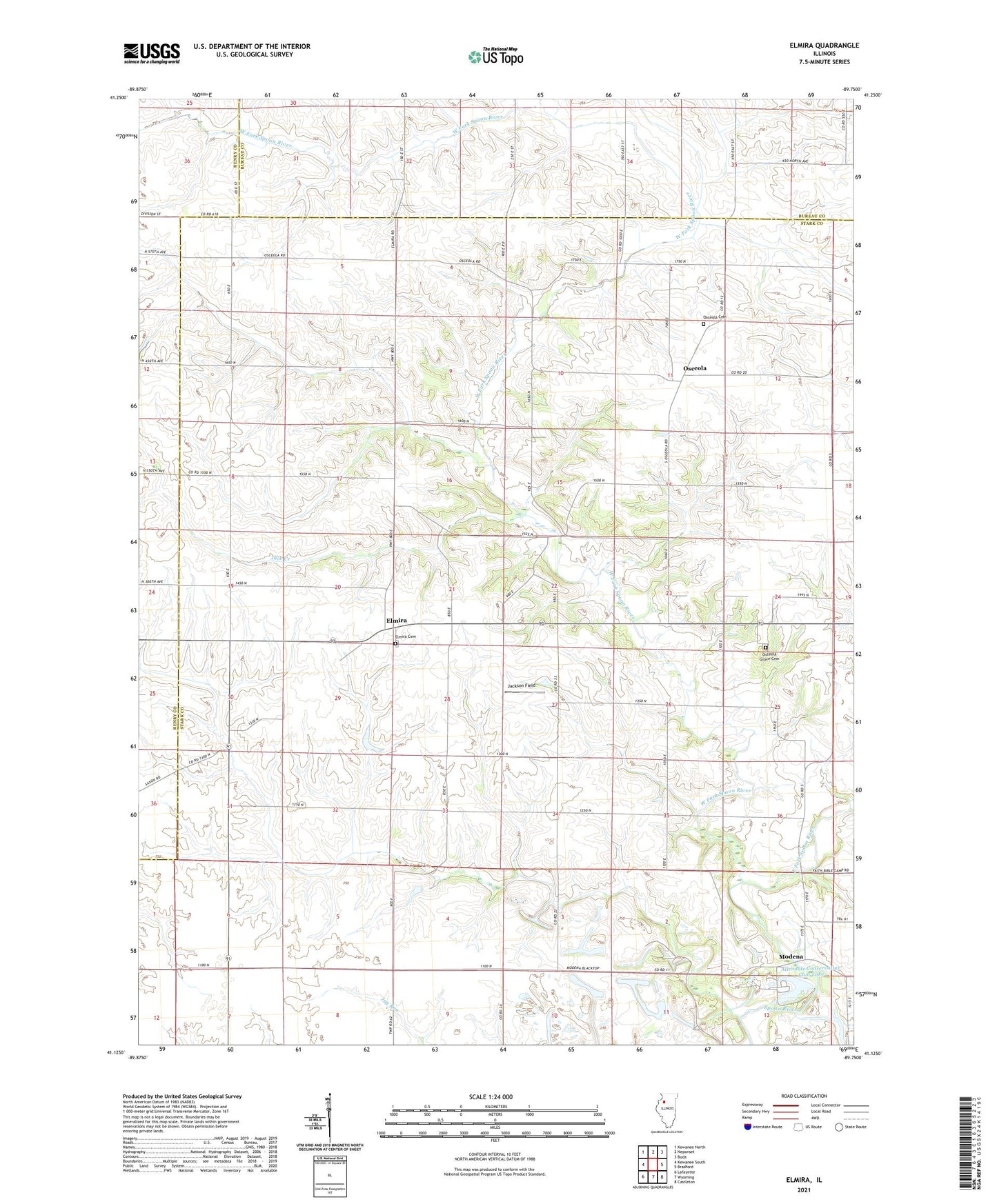
Elmira Illinois US Topo Map
Couldn't load pickup availability
2024 topographic map quadrangle Elmira in the state of Illinois. Scale: 1:24000. Based on the newly updated USGS 7.5' US Topo map series, this map is in the following counties: Stark, Bureau, Henry. The map contains contour data, water features, and other items you are used to seeing on USGS maps, but also has updated roads and other features. This is the next generation of topographic maps. Printed on high-quality waterproof paper with UV fade-resistant inks.
Quads adjacent to this one:
West: Kewanee South
Northwest: Kewanee North
North: Neponset
Northeast: Buda
East: Bradford
Southeast: Castleton
South: Wyoming
Southwest: Lafayette
This map covers the same area as the classic USGS quad with code o41089b7.
Contains the following named places: Allendale Conservation Club Lake, Allendale Conservation Club Lake Dam, East Fork Spoon River, Elmira, Elmira Cemetery, Elmira United Presbyterian Church, Holmes School, Jack Creek, Jack Creek School, Jackson Field, Lowell School, Modena, Mound School, North Star School, Osceola, Osceola Cemetery, Osceola Grove Cemetery, Osceola Grove School, Rist School, Township of Elmira, Waldron, West Fork Spoon River