MyTopo
Kirkwood West Illinois US Topo Map
Couldn't load pickup availability
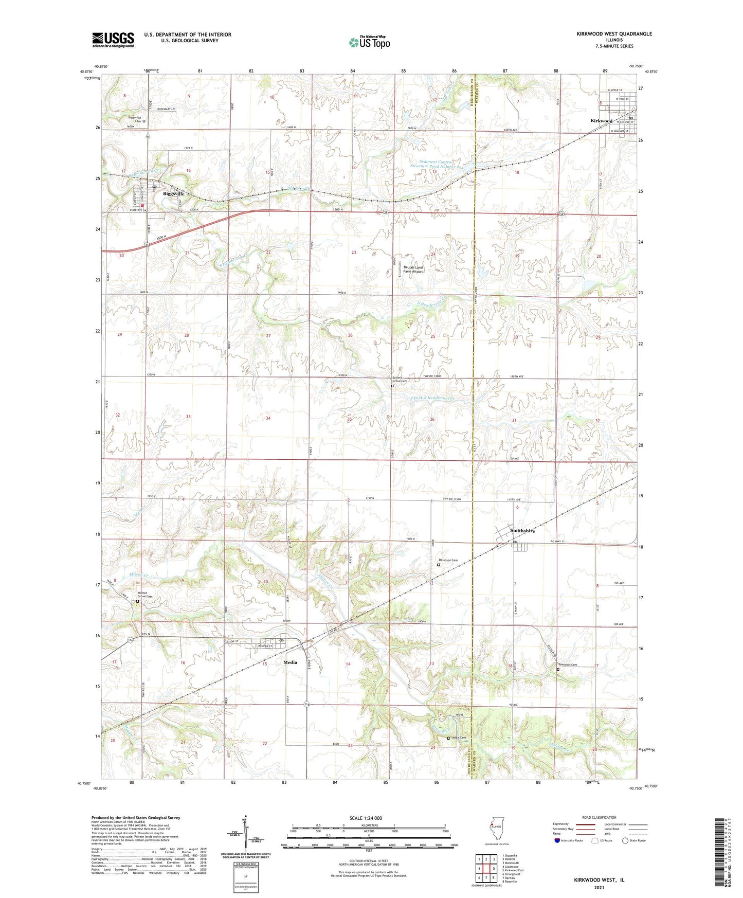
2024 topographic map quadrangle Kirkwood West in the state of Illinois. Scale: 1:24000. Based on the newly updated USGS 7.5' US Topo map series, this map is in the following counties: Henderson, Warren. The map contains contour data, water features, and other items you are used to seeing on USGS maps, but also has updated roads and other features. This is the next generation of topographic maps. Printed on high-quality waterproof paper with UV fade-resistant inks.
Quads adjacent to this one:
West: Gladstone
Northwest: Oquawka
North: Rozetta
Northeast: Monmouth
East: Kirkwood East
Southeast: Roseville
South: Raritan
Southwest: Stronghurst
This map covers the same area as the classic USGS quad with code o40090g7.
Contains the following named places: Adair Cemetery, Beulah Land Farm Airport, Biggsville, Biggsville Ambulance Service, Biggsville Cemetery, Biggsville Fire Protection District, Biggsville Post Office, Biggsville United Methodist Church, Biggsville United Presbyterian Church, Columbia School, Corzatt Airport, Davidson Cemetery, Dutch Row School, Ellison, Ellison School, Grove Hill School, Kirkwood Post Office, Kirkwood United Methodist Church, Maple Grove School, McCartney School, Media, Media - Stronghurst - Terre Haute Fire Protection District Station 2, Media Post Office, Norris Lake, Norris Lake Dam, Old Tom Creek, Rankin School, Salter's Grove Cemetery, Sediment Control Structure Pond Number 22, Sediment Control Structure Pond Number 22 Dam, Smithshire, Smithshire Post Office, South Fork South Henderson Creek, Southern Junior High School, Township Cemetery, Township of Biggsville, Township of Media, Twentieth Century School, Village of Biggsville, Village of Media, Walnut Grove Cemetery, Westminster Church, ZIP Codes: 61418, 61447, 61478