MyTopo
Oquawka Illinois US Topo Map
Couldn't load pickup availability
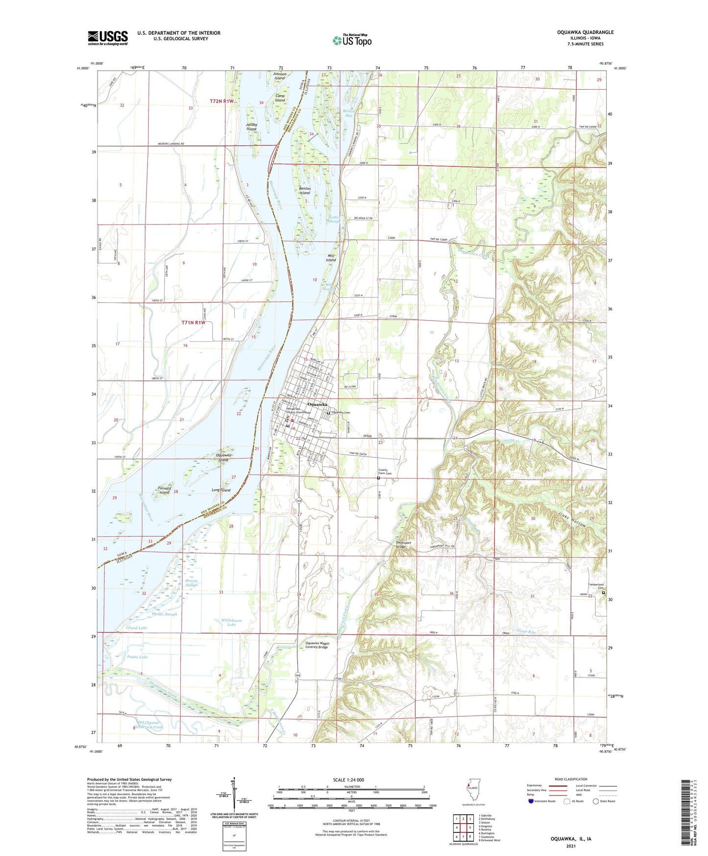
2024 topographic map quadrangle Oquawka in the states of Illinois, Iowa. Scale: 1:24000. Based on the newly updated USGS 7.5' US Topo map series, this map is in the following counties: Henderson, Des Moines. The map contains contour data, water features, and other items you are used to seeing on USGS maps, but also has updated roads and other features. This is the next generation of topographic maps. Printed on high-quality waterproof paper with UV fade-resistant inks.
Quads adjacent to this one:
West: Kingston
Northwest: Oakville
North: Keithsburg
Northeast: Seaton
East: Rozetta
Southeast: Kirkwood West
South: Gladstone
Southwest: Burlington
This map covers the same area as the classic USGS quad with code o40090h8.
Contains the following named places: Agri Grain Marketing Elevator, Benton Bay, Benton Island, Benton Slough, Camp Island, Casey Barrow Landing, Cedar Oak School, County Farm Cemetery, Cumberland Cemetery, Davenport Bridge, Delabar State Park, Furnald Island, Goose Run, Great Oaks Picnic Area, Henderson County Farm, Henderson County Sheriff's Office, Island Lake, Jacoby Island, Jinks Hollow, Little Brick School, Little Deer Picnic Area, Long Island, Lynnville School, Meekers Landing, Mill Island, Mill Slough, North Henderson County Ambulance Service - Oquawka, Oquawka, Oquawka Cemetery, Oquawka Fire Department, Oquawka Island, Oquawka Post Office, Oquawka Wagon Covered Bridge, Phelps Slough, Pogue Lake, Pogue School, Prairie Slough, Sands Picnic Area, Smith Creek, Smith School, South Henderson Creek, Sunset Picnic Area, Township of Jackson, Township of Oquawka, Village of Oquawka, Whitehouse Lake, ZIP Code: 61469