MyTopo
Le Roy Illinois US Topo Map
Couldn't load pickup availability
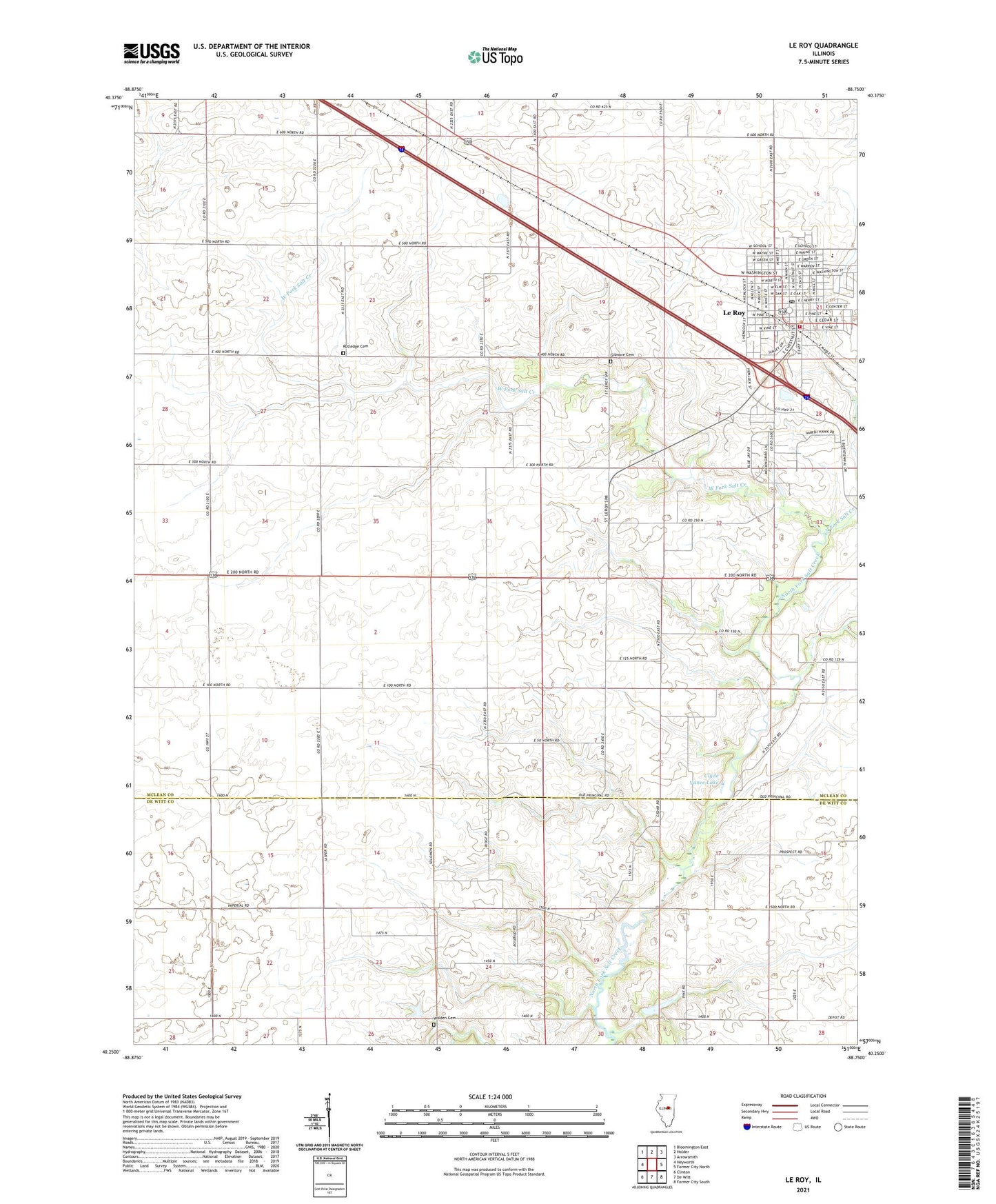
2024 topographic map quadrangle Le Roy in the state of Illinois. Scale: 1:24000. Based on the newly updated USGS 7.5' US Topo map series, this map is in the following counties: McLean, De Witt. The map contains contour data, water features, and other items you are used to seeing on USGS maps, but also has updated roads and other features. This is the next generation of topographic maps. Printed on high-quality waterproof paper with UV fade-resistant inks.
Quads adjacent to this one:
West: Heyworth
Northwest: Bloomington East
North: Holder
Northeast: Arrowsmith
East: Farmer City North
Southeast: Farmer City South
South: De Witt
Southwest: Clinton
This map covers the same area as the classic USGS quad with code o40088c7.
Contains the following named places: City of Le Roy, Clyde Vance Lake, Clyde Vance Lake Dam, Crumbaugh Memorial Public Library, Field School, Gilmore Cemetery, Imperial School, Le Roy, Le Roy Community Fire Protection District, Le Roy Elementary School, Le Roy Emergency Ambulance Service, Le Roy High School, Le Roy Junior High School, Le Roy Post Office, LeRoy City Hall, Long Point Creek, Mathews Landing Strip, Rucker Chapel, Rutledge Cemetery, South Downs School, Township of Downs, Township of Wilson, Walden Cemetery, Washington School, West Fork Salt Creek, ZIP Code: 61752