MyTopo
Heyworth Illinois US Topo Map
Couldn't load pickup availability
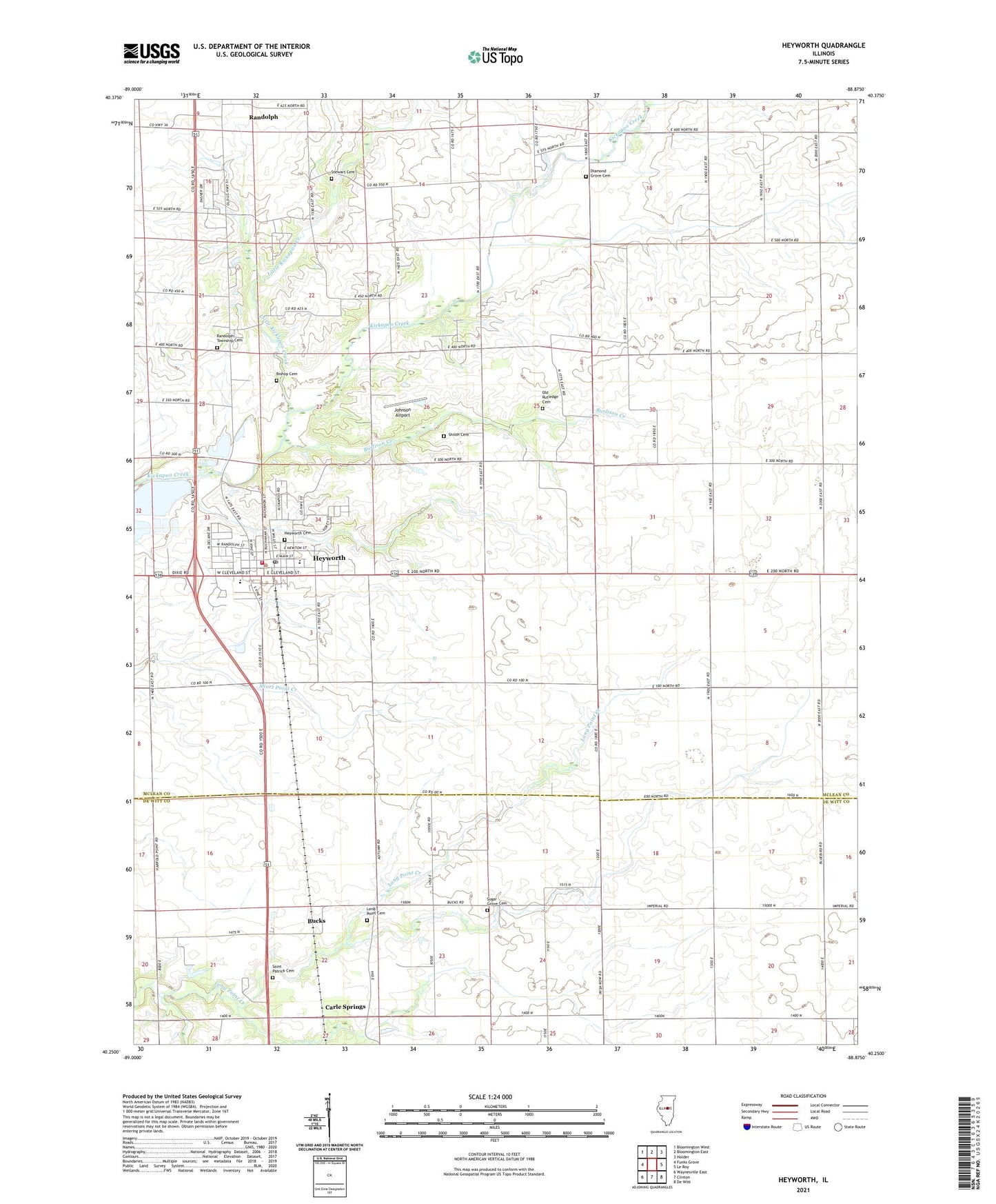
2024 topographic map quadrangle Heyworth in the state of Illinois. Scale: 1:24000. Based on the newly updated USGS 7.5' US Topo map series, this map is in the following counties: McLean, De Witt. The map contains contour data, water features, and other items you are used to seeing on USGS maps, but also has updated roads and other features. This is the next generation of topographic maps. Printed on high-quality waterproof paper with UV fade-resistant inks.
Quads adjacent to this one:
West: Funks Grove
Northwest: Bloomington West
North: Bloomington East
Northeast: Holder
East: Le Roy
Southeast: De Witt
South: Clinton
Southwest: Waynesville East
This map covers the same area as the classic USGS quad with code o40088c8.
Contains the following named places: Bishop Cemetery, Bucks, Burlison Creek, Carle Springs, Diamond Grove Cemetery, Diamond Grove Church, Hamlow RLA Airport, Heyworth, Heyworth Ambulance Service, Heyworth Cemetery, Heyworth Elementary School, Heyworth High School, Heyworth Post Office, Johnson Airport, Liberty School, Little Kickapoo Creek, Littleville, Long Point Cemetery, Long Point Church, Lytleville School, Old Rutledge Cemetery, Progress School, Quinton Landing Strip, Randolph Township Cemetery, Randolph Township Fire Department, Saint Patrick Cemetery, Shiloh Cemetery, Stewart Cemetery, Sugar Grove Cemetery, Township of Randolph, Valley Center Church, Village of Heyworth, ZIP Code: 61745