MyTopo
Manchester Illinois US Topo Map
Couldn't load pickup availability
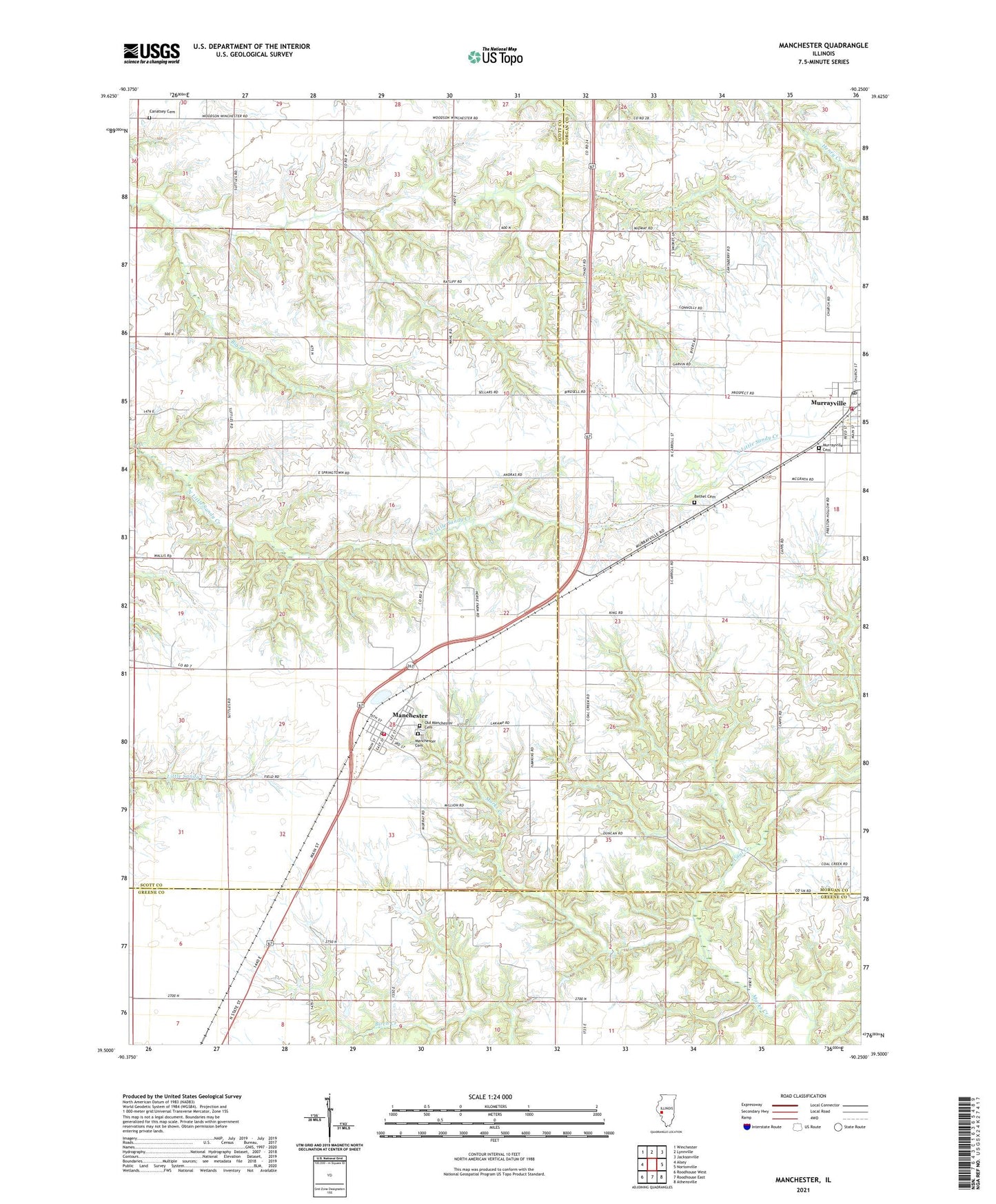
2024 topographic map quadrangle Manchester in the state of Illinois. Scale: 1:24000. Based on the newly updated USGS 7.5' US Topo map series, this map is in the following counties: Scott, Morgan, Greene. The map contains contour data, water features, and other items you are used to seeing on USGS maps, but also has updated roads and other features. This is the next generation of topographic maps. Printed on high-quality waterproof paper with UV fade-resistant inks.
Quads adjacent to this one:
West: Alsey
Northwest: Winchester
North: Lynnville
Northeast: Jacksonville
East: Nortonville
Southeast: Athensville
South: Roodhouse East
Southwest: Roodhouse West
This map covers the same area as the classic USGS quad with code o39090e3.
Contains the following named places: Akers School, Bethel Cemetery, Big Branch, Canatsey Cemetery, Carnes School, Coal Creek, East Union Church, Harmony Hills Campground, Harts School, Independence School, Manchester, Manchester Baptist Church, Manchester Cemetery, Manchester Election Precinct, Manchester Post Office, Manchester Volunteer Fire Department, McCracken School, Mount Olive School, Murrayville, Murrayville Baptist Church, Murrayville Cemetery, Murrayville Fire District, Murrayville Number 2 Election Precinct, Murrayville Post Office, Murrayville United Methodist Church, Oak Hill School, Old Manchester Cemetery, Saint Bartholomew Church, Union School, Village of Manchester, Village of Murrayville, WEAI-FM (Lynnville), ZIP Code: 62663