MyTopo
Mermet Illinois US Topo Map
Couldn't load pickup availability
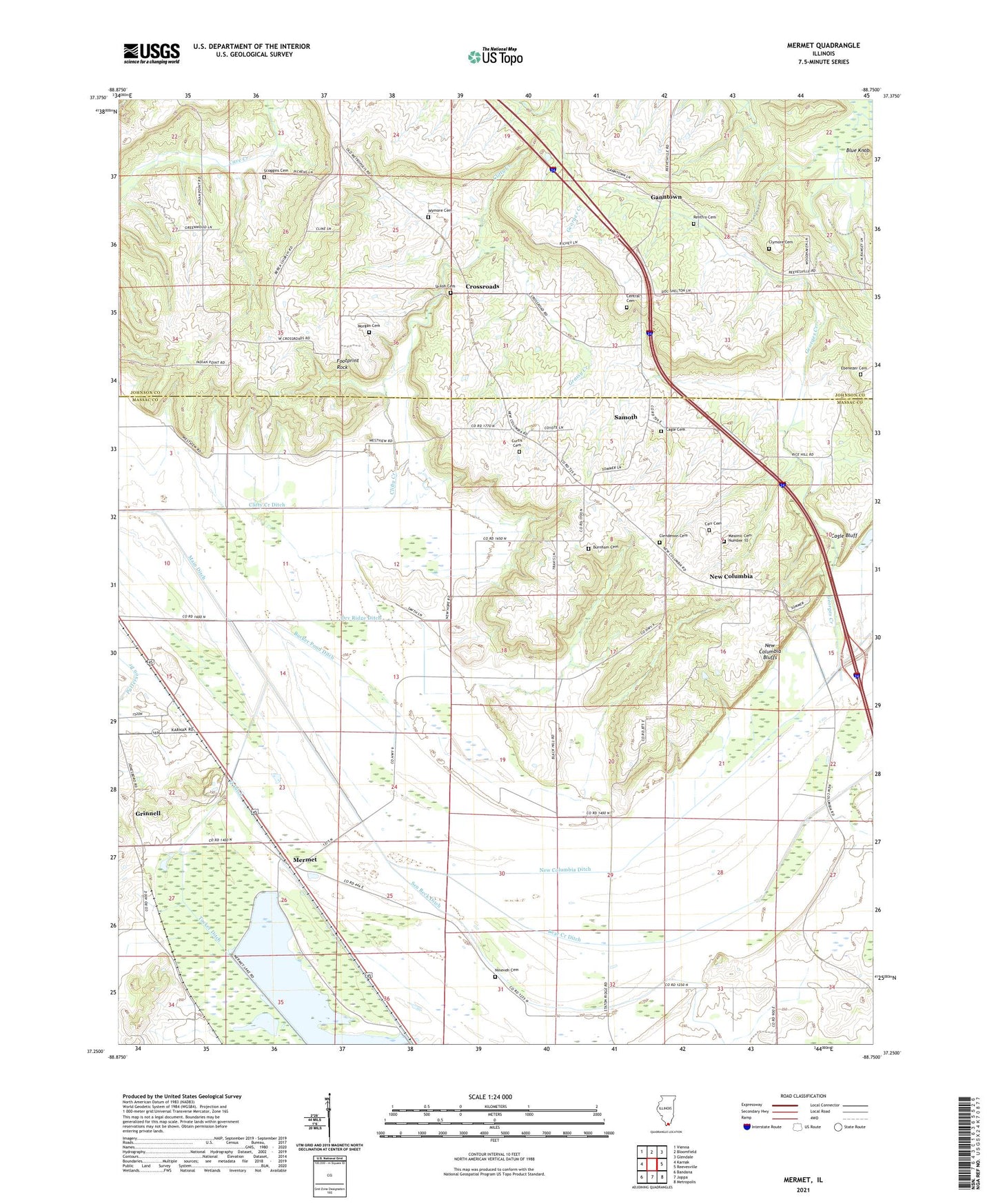
2024 topographic map quadrangle Mermet in the state of Illinois. Scale: 1:24000. Based on the newly updated USGS 7.5' US Topo map series, this map is in the following counties: Massac, Johnson. The map contains contour data, water features, and other items you are used to seeing on USGS maps, but also has updated roads and other features. This is the next generation of topographic maps. Printed on high-quality waterproof paper with UV fade-resistant inks.
Quads adjacent to this one:
West: Karnak
Northwest: Vienna
North: Bloomfield
Northeast: Glendale
East: Reevesville
Southeast: Metropolis
South: Joppa
Southwest: Bandana
This map covers the same area as the classic USGS quad with code o37088c7.
Contains the following named places: Berea Church, Berea School, Black Hill School, Blue Knob, Bucker Pond Ditch, Burnham Cemetery, Cagle Cemetery, Carr Cemetery, Central Cemetery, Central School, Clendenon Cemetery, Clifty Creek, Clifty Creek Ditch, Clifty Creek School, Clymore Cemetery, Crossroads, Curtis Cemetery, Dry Ridge Ditch, Ebenezer Cemetery, Enterprise School, Footprint Rock, Ganntown, Georges Creek, Georges Creek Election Precinct, Glenwood School, Grantsburg Number 2 Election Precinct, Grassy Creek, Grinnell, Main Ditch, Masonic Cemetery Number 10, Mermet, Mermet Lake, Mermet Lake State Conservation Area, Morgan Cemetery, New Columbia, New Columbia Bluffs, New Columbia Ditch, New Hope Church, Nineveh Cemetery, Oakland School, Pleasant Union School, Q Ditch, Rentfro Cemetery, Risinger Spur, Round Lake, Samoth, Scoggins Cemetery, Sen Beck Ditch, Shiloh Cemetery, Tucker Ditch, Wymore Cemetery, ZIP Codes: 62908, 62943