MyTopo
Mount Pulaski Illinois US Topo Map
Couldn't load pickup availability
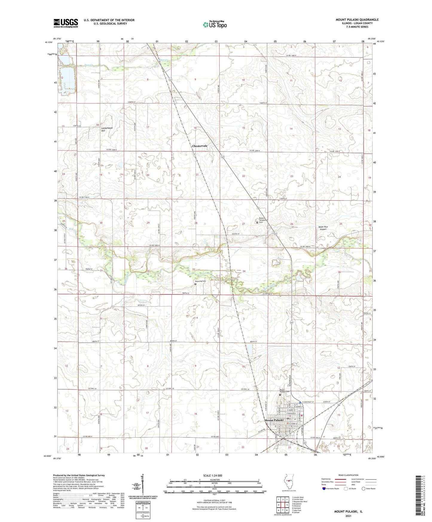
2024 topographic map quadrangle Mount Pulaski in the state of Illinois. Scale: 1:24000. Based on the newly updated USGS 7.5' US Topo map series, this map is in the following counties: Logan. The map contains contour data, water features, and other items you are used to seeing on USGS maps, but also has updated roads and other features. This is the next generation of topographic maps. Printed on high-quality waterproof paper with UV fade-resistant inks.
Quads adjacent to this one:
West: Broadwell
Northwest: Lincoln West
North: Lincoln East
Northeast: Waynesville West
East: Chestnut
Southeast: Latham
South: Lake Fork
Southwest: Cornland
This map covers the same area as the classic USGS quad with code o40089a3.
Contains the following named places: Allsopp Sand and Gravel Pit, Bowers Templeman Cemetery, Buchanan School, Buckles School, Chestervale, City of Mount Pulaski, Doolittle School, Downing Cemetery, First Christian Church, French's Chapel School, Industry School, Laughery School, Layman School, Lockenauer Hill, Logan County, Mason Airport, Miller RLA Airport, Mount Pulaski, Mount Pulaski Cemetery, Mount Pulaski Courthouse, Mount Pulaski Elementary School, Mount Pulaski Fire Protection District, Mount Pulaski High School, Mount Pulaski Police Department, Mount Pulaski Post Office, Pegram School, Pleasant Grove School, Primm School, Saint Johns Lutheran Church, Saint Thomas Aquinas Church, Sugar Grove School, Tomlinson Siding, Township of Chester, Zion Lutheran Church