MyTopo
Lake Fork Illinois US Topo Map
Couldn't load pickup availability
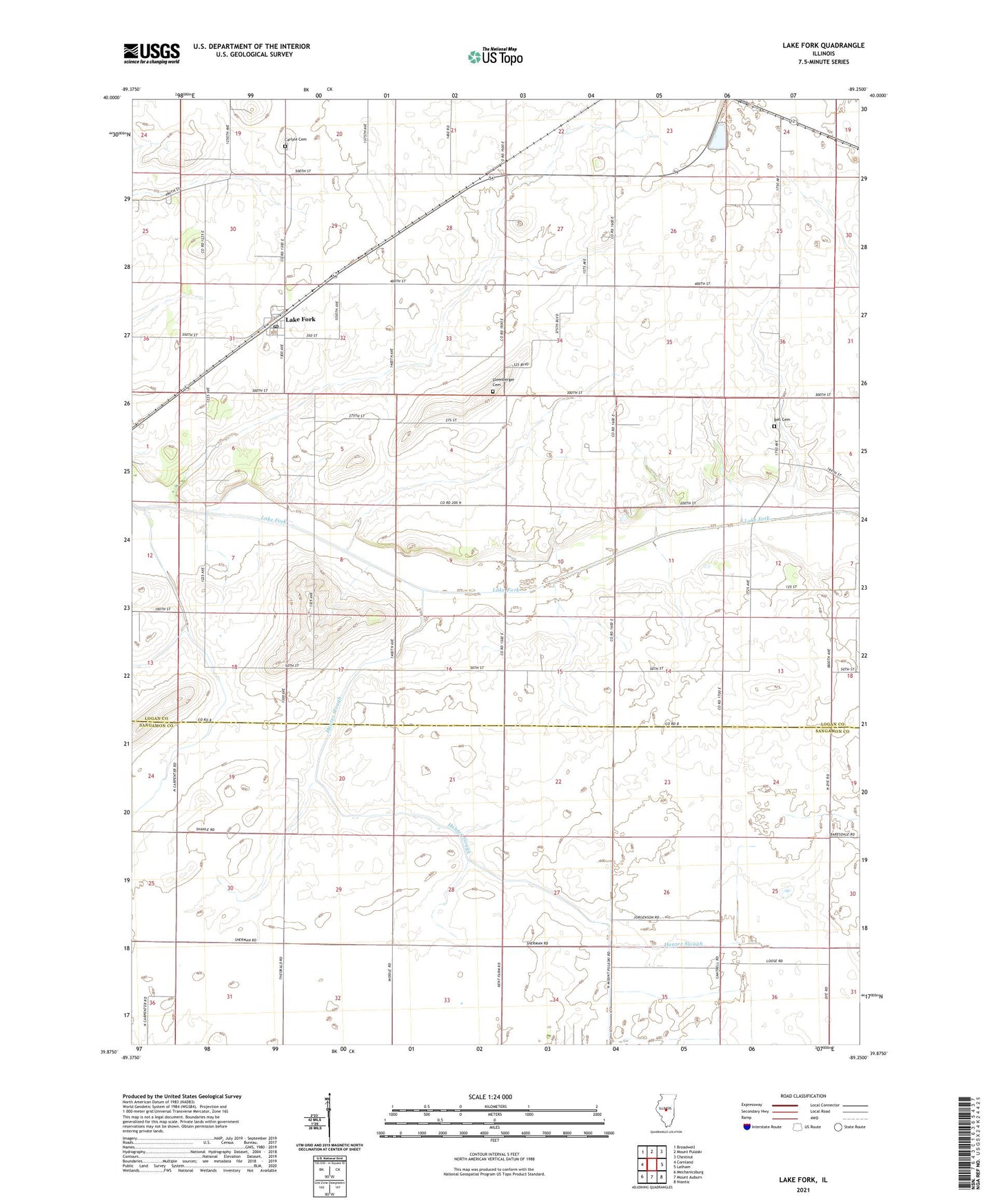
2024 topographic map quadrangle Lake Fork in the state of Illinois. Scale: 1:24000. Based on the newly updated USGS 7.5' US Topo map series, this map is in the following counties: Logan, Sangamon. The map contains contour data, water features, and other items you are used to seeing on USGS maps, but also has updated roads and other features. This is the next generation of topographic maps. Printed on high-quality waterproof paper with UV fade-resistant inks.
Quads adjacent to this one:
West: Cornland
Northwest: Broadwell
North: Mount Pulaski
Northeast: Chestnut
East: Latham
Southeast: Niantic
South: Mount Auburn
Southwest: Mechanicsburg
This map covers the same area as the classic USGS quad with code o39089h3.
Contains the following named places: Bell Cemetery, Birks School, Carlyle Cemetery, Copeland Church, Hunter Slough, Lake Fork, Lake Fork Christian Church, Lake Fork Post Office, Ray School, Steenberger Cemetery, Township of Mount Pulaski, Vail Memorial Chapel, ZIP Codes: 62541, 62548