MyTopo
Newton Illinois US Topo Map
Couldn't load pickup availability
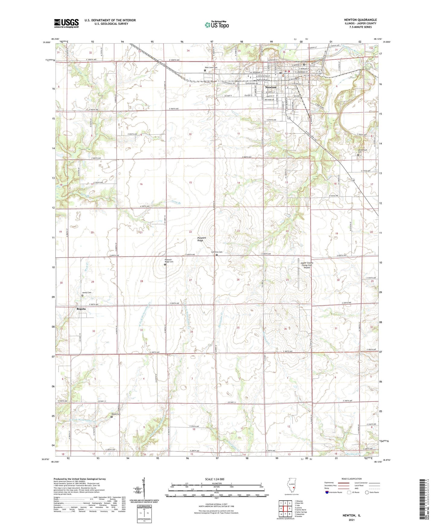
2024 topographic map quadrangle Newton in the state of Illinois. Scale: 1:24000. Based on the newly updated USGS 7.5' US Topo map series, this map is in the following counties: Jasper. The map contains contour data, water features, and other items you are used to seeing on USGS maps, but also has updated roads and other features. This is the next generation of topographic maps. Printed on high-quality waterproof paper with UV fade-resistant inks.
Quads adjacent to this one:
West: Latona
Northwest: Wheeler
North: Rose Hill
Northeast: Yale
East: Sainte Marie
Southeast: Dundas
South: Wakefield
Southwest: Sailor Springs
This map covers the same area as the classic USGS quad with code o38088h2.
Contains the following named places: Bogota, Bogota Post Office, Buck Grove School, Bunker Grove School, Calvin School, Center School, City of Newton, Cummins Cemetery, Eaton Farms, First Baptist Church, Greenwood School, Happy Hollow School, Honey Cemetery, Jasper County Ambulance Service, Jasper County Flying Club Airport, Jasper County Safety Council Heliport, Jasper County Sheriff's Office, Long Branch School, M and P Farm, Maple Hill Farm, Moulden School, New Life Christian Center, Newton, Newton Community High School, Newton Elementary School, Newton Police Department, Newton Post Office, Newton Water Treatment Plant, Pleasant Ridge, Pleasant Ridge Cemetery, Pleasant Ridge School, Riverside Cemetery, Saint Thomas Church, Saint Thomas School, Schafer Farms, Scott Avenue Christian Church, Shamrock, Smithenry Farms, Township of Smallwood, Vanderhoof Cemetery, Vanderhoof School, Wade Community Fire Protection District, Wakefield School, West Lawn Cemetery, Woods Cemetery, ZIP Code: 62448