MyTopo
Sainte Marie Illinois US Topo Map
Couldn't load pickup availability
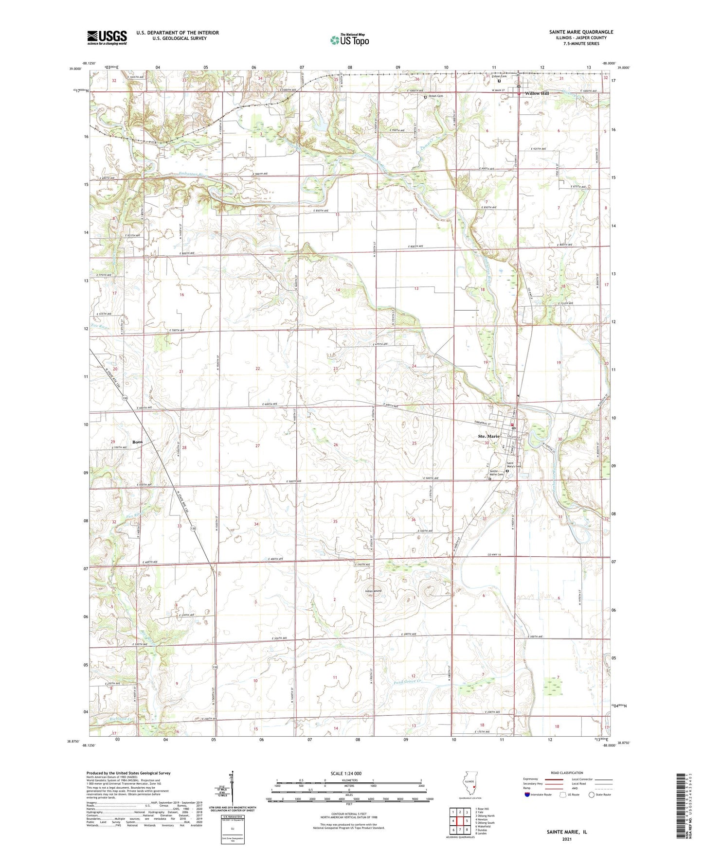
2024 topographic map quadrangle Sainte Marie in the state of Illinois. Scale: 1:24000. Based on the newly updated USGS 7.5' US Topo map series, this map is in the following counties: Jasper. The map contains contour data, water features, and other items you are used to seeing on USGS maps, but also has updated roads and other features. This is the next generation of topographic maps. Printed on high-quality waterproof paper with UV fade-resistant inks.
Quads adjacent to this one:
West: Newton
Northwest: Rose Hill
North: Yale
Northeast: Oblong North
East: Oblong South
Southeast: Landes
South: Dundas
Southwest: Wakefield
This map covers the same area as the classic USGS quad with code o38088h1.
Contains the following named places: Bergbower Farm, Boos, Camp Creek, Catt School, Crooked Creek, Dallmier School, Eidson Cemetery, Indian Mound, Kaufmann Cattle Farm, Kessler School, Midway School, Ochs Farm, Ochs School, Onion Prairie Church, Onion Prairie School, Pond Grove Creek, Pond Grove School, Reis Farms, Richards School, Richland Creek, Saint Mary of the Assumption Church, Saint Mary's Cemetery, Sainte Marie, Sainte Marie Cemetery, Sainte Marie Elementary School, Sainte Marie Pilgrim Holiness Church, Sainte Marie Post Office, Sainte Marie Volunteer Fire Department, Shiloh Cemetery, Shiloh Church, Township of Fox, Township of Sainte Marie, Township of Willow Hill, Village of Sainte Marie, Village of Willow Hill, Willow Hill, Willow Hill Elementary School, Willow Hill Fire Department, Willow Hill Post Office, Wolf Creek, ZIP Codes: 62459, 62475