MyTopo
Plainview Illinois US Topo Map
Couldn't load pickup availability
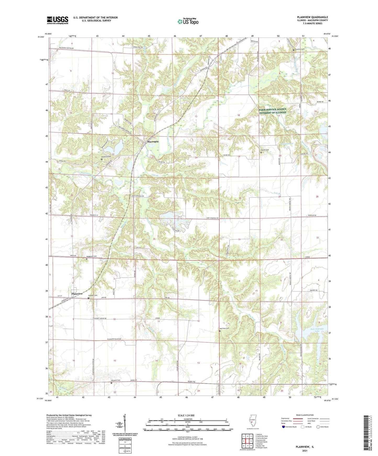
2024 topographic map quadrangle Plainview in the state of Illinois. Scale: 1:24000. Based on the newly updated USGS 7.5' US Topo map series, this map is in the following counties: Macoupin. The map contains contour data, water features, and other items you are used to seeing on USGS maps, but also has updated roads and other features. This is the next generation of topographic maps. Printed on high-quality waterproof paper with UV fade-resistant inks.
Quads adjacent to this one:
West: Summerville
Northwest: Hettick
North: Carlinville West
Northeast: Carlinville East
East: Gillespie North
Southeast: Gillespie South
South: Bunker Hill
Southwest: Shipman
This map covers the same area as the classic USGS quad with code o39089b8.
Contains the following named places: Adams Branch, Beaver Dam Lake, Beaver Dam State Park, Beaver Lake Dam, Brayford Cemetery, Broom Orchard, Combes Cemetery, Denby Prairie Nature Preserve, Dorman School, Dry Fork, East Liberty School, Emerick Cemetery, Hacke Cemetery, Hillyard Cemetery, Honey Creek, Hurricane Creek, Kent Branch, Lake Catatoga, Lake Catatoga Dam, Lick Branch, Macoupin, May Branch, Morrison Cemetery, New Gillespie Lake, New Gillespie Lake Dam, Oak Hill School, Plainview, Plainview Post Office, Pleasant Grove School, Smith Reservoir, Smith Reservoir Dam, Snedeker Grove School, Spanish Needle Community Center, Spanish Needle Creek, Spanish Needle School, Suhling Pond, Township of Hillyard, Township of Polk, Waggoner Cemetery