MyTopo
Ray Illinois US Topo Map
Couldn't load pickup availability
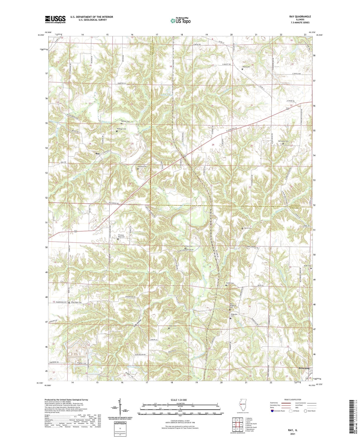
2024 topographic map quadrangle Ray in the state of Illinois. Scale: 1:24000. Based on the newly updated USGS 7.5' US Topo map series, this map is in the following counties: Schuyler, Fulton. The map contains contour data, water features, and other items you are used to seeing on USGS maps, but also has updated roads and other features. This is the next generation of topographic maps. Printed on high-quality waterproof paper with UV fade-resistant inks.
Quads adjacent to this one:
West: Rushville North
Northwest: Industry
North: Vermont
Northeast: Ipava
East: Astoria
Southeast: Clear Lake
South: Beardstown
Southwest: Rushville South
This map covers the same area as the classic USGS quad with code o40090b4.
Contains the following named places: Bader Cemetery, Brushy Branch, Burress Cemetery, Campbell Landing Strip, Christian Neck Cemetery, Christian Neck Church, Christian Neck School, East Center School, Edgar Cemetery, Fox Ridge School, Gaines Branch, Good Hope Cemetery, Good Hope School, Gorsuch Cemetery, Harris Branch, Harris Cemetery, McKee Branch, Mount Zion School, Oak Grove Cemetery, Oak Grove School, Old Ridgeville Cemetery, Onion School, Peabody Lake, Peabody Lake Dam, Pittenger Cemetery, Pleasant Ridge School, Pleasantdale School, Ray, Ray Post Office, Richie Branch, Ridgeville Cemetery, Ridgeville Church, Ridgeville School, Salem Cemetery, Scab Hollow, Steele Cemetery, Sullivan Lake, Sullivan Lake Dam, Township of Astoria, Township of Browning, Tracy Cemetery