MyTopo
Vermont Illinois US Topo Map
Couldn't load pickup availability
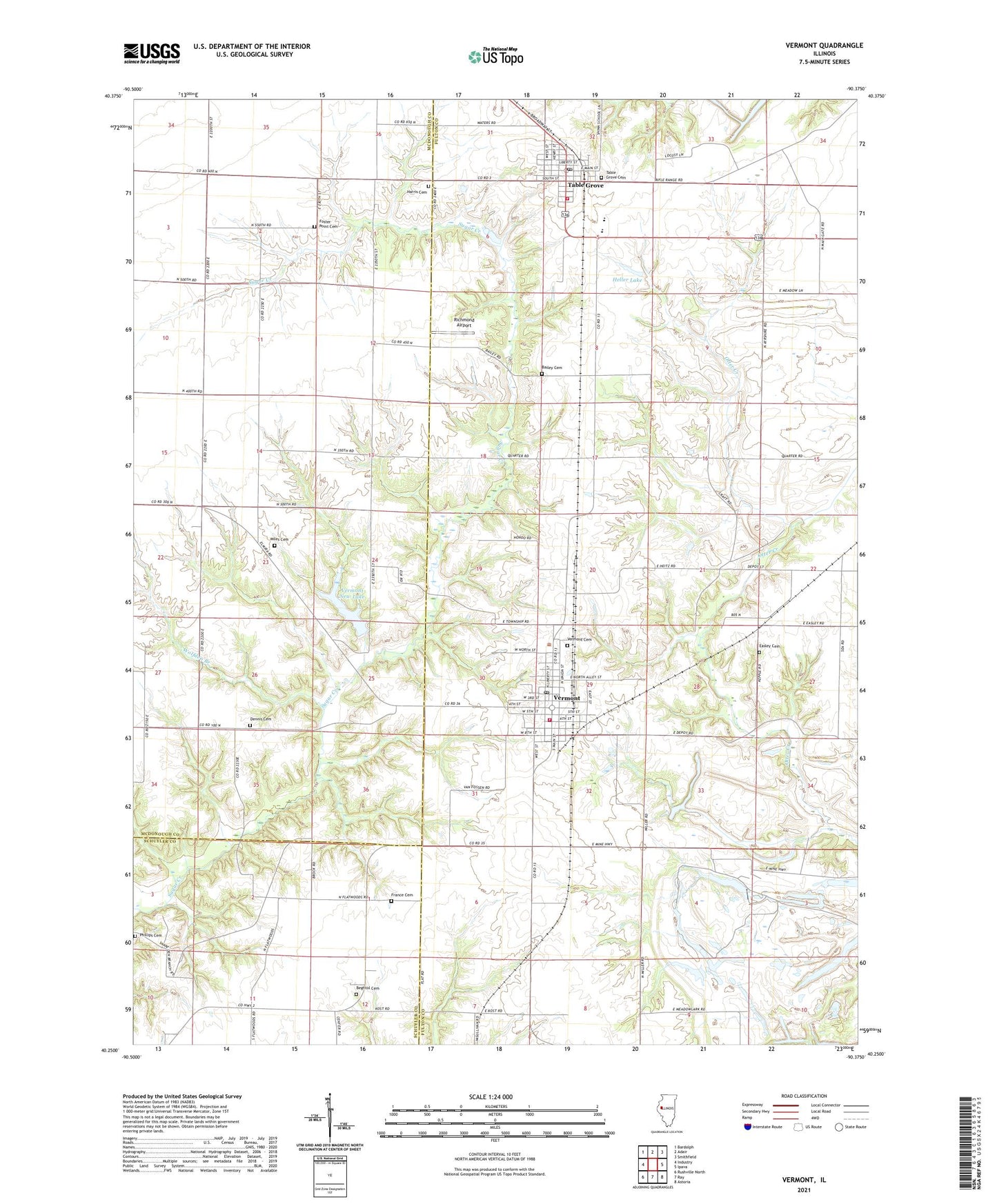
2024 topographic map quadrangle Vermont in the state of Illinois. Scale: 1:24000. Based on the newly updated USGS 7.5' US Topo map series, this map is in the following counties: Fulton, McDonough, Schuyler. The map contains contour data, water features, and other items you are used to seeing on USGS maps, but also has updated roads and other features. This is the next generation of topographic maps. Printed on high-quality waterproof paper with UV fade-resistant inks.
Quads adjacent to this one:
West: Industry
Northwest: Bardolph
North: Adair
Northeast: Smithfield
East: Ipava
Southeast: Astoria
South: Ray
Southwest: Rushville North
This map covers the same area as the classic USGS quad with code o40090c4.
Contains the following named places: Adams Cemetery, Bailey Cemetery, Bailey School, Beghtol Cemetery, Cox School, Dennis Cemetery, Diversion Drainage Dam, Diversion Drainage Lake, Easley Cemetery, Farr School, Flatwoods School, Foster Point Cemetery, Foster Point School, France Cemetery, Freshwater Lake, Freshwater Lake Dam, Harris Cemetery, Harvey School, Heller Lake, Heller Lake Dam, Hickory Grove School, Kost School, Miles Cemetery, Mud Acre School, Phillips Cemetery, Richmond Airport, Sugar Creek Cumberland Prestyterian Church, Table Grove, Table Grove Cemetery, Table Grove Community Church, Table Grove Fire Protection District, Table Grove Post Office, Table Grove School, Table Grove Village Square, Township of Vermont, Union Center School, Union Chapel Cemetery, V I T Junior-Senior High School, Vermont, Vermont Cemetery, Vermont Fire Protection District, Vermont New Lake, Vermont New Lake Dam, Vermont Post Office, Vermont School, Village of Table Grove, Village of Vermont, Wolfden Branch, ZIP Code: 61484