MyTopo
Scottville Illinois US Topo Map
Couldn't load pickup availability
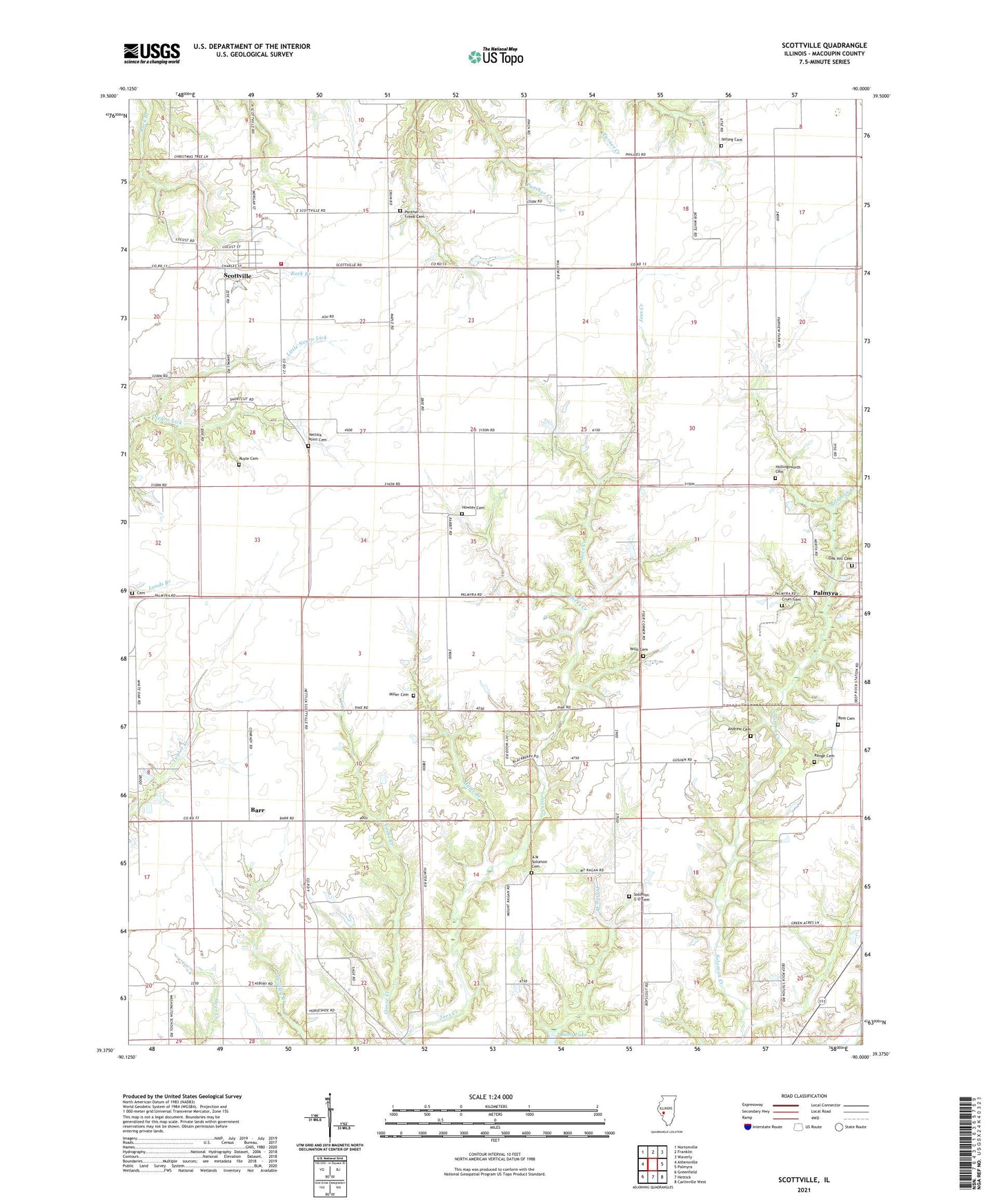
2024 topographic map quadrangle Scottville in the state of Illinois. Scale: 1:24000. Based on the newly updated USGS 7.5' US Topo map series, this map is in the following counties: Macoupin. The map contains contour data, water features, and other items you are used to seeing on USGS maps, but also has updated roads and other features. This is the next generation of topographic maps. Printed on high-quality waterproof paper with UV fade-resistant inks.
Quads adjacent to this one:
West: Athensville
Northwest: Nortonville
North: Franklin
Northeast: Waverly
East: Palmyra
Southeast: Carlinville West
South: Hettick
Southwest: Greenfield
This map covers the same area as the classic USGS quad with code o39090d1.
Contains the following named places: A M Solomon Cemetery, Andrew Cemetery, Asbury Church, Barr, Bethel School, Cemetery, Crum Cemetery, Goose Creek, Goshen School, Hettick Point Cemetery, Hettick Point School, Hicks Creek, Hollingsworth Cemetery, Howser Cemetery, James W Andrew Airport, Landreth School, Little Negro Lick, Maxfield School, Miller Branch, Miller Cemetery, Mount Moriah School, Mount Olive School, MSDGC Dam Number 5, Nifong Cemetery, Northwestern Area Ambulance and Rescue Service, Oak Hill Cemetery, Panther Creek Cemetery, Range Cemetery, Ross Cemetery, Ruyle Cemetery, Scottville, Scottville - Modesto Rural Fire Protection District, Scottville Post Office, Solomon G O Cemetery, Township of Barr, Township of Scottville, Victory School, Village of Scottville, Wills Cemetery, Workman School, ZIP Code: 62674