MyTopo
Waverly Illinois US Topo Map
Couldn't load pickup availability
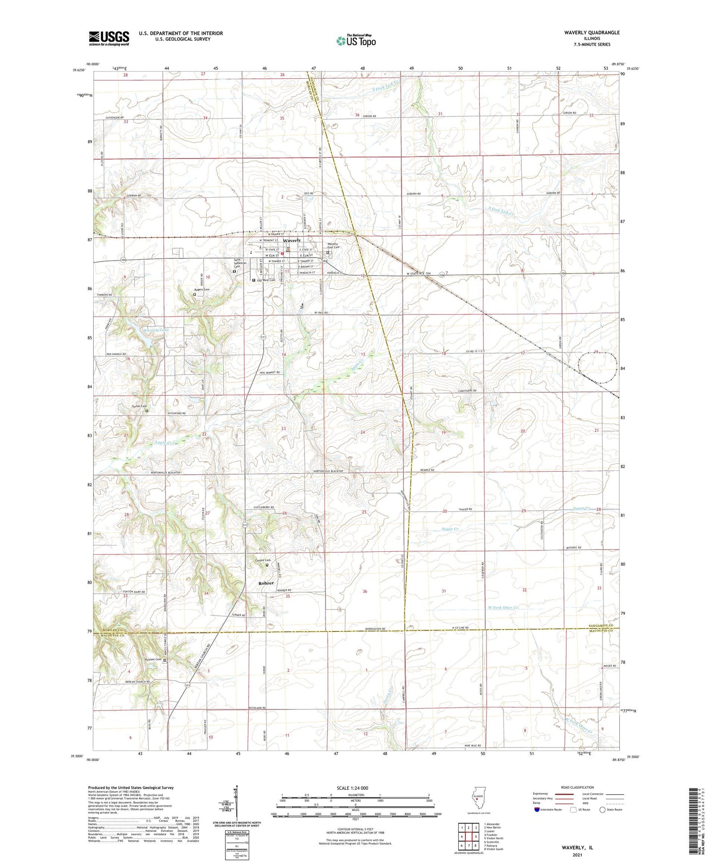
2024 topographic map quadrangle Waverly in the state of Illinois. Scale: 1:24000. Based on the newly updated USGS 7.5' US Topo map series, this map is in the following counties: Sangamon, Morgan, Macoupin. The map contains contour data, water features, and other items you are used to seeing on USGS maps, but also has updated roads and other features. This is the next generation of topographic maps. Printed on high-quality waterproof paper with UV fade-resistant inks.
Quads adjacent to this one:
West: Franklin
Northwest: Alexander
North: New Berlin
Northeast: Loami
East: Virden North
Southeast: Virden South
South: Palmyra
Southwest: Scottville
This map covers the same area as the classic USGS quad with code o39089e8.
Contains the following named places: Apollonia School, Appalokia, Chapman Point School, Christ Lutheran Church, City of Waverly, Conlee Cemetery, First Baptist Church, Forest Valley School, Gourdneck School, Greenland School, Locust Grove School, Old West Cemetery, Panhandle Eastern Waverly Lake Dam, Prospect School, Prospect Station, Providence School, Pulliam Cemetery, Rogers Cemetery, Rohrer, Rohrer Church, Ruthland School, Saint Sebastian Cemetery, Saint Sebastian Church, Scioto School, Sherman School, Stayton Dairy Farm, Stirrup Grove Post Office, Turner Cemetery, Vancil Union Church, Vancils Point Post Office, Waverly, Waverly Christian Church, Waverly East Cemetery, Waverly Elementary School, Waverly First United Methodist Church, Waverly High School, Waverly Lake, Waverly Number 1 Election Precinct, Waverly Number 2 Election Precinct, Waverly Police Department, Waverly Post Office, Waverly Public Library, Waverly Volunteer Fire Department, White Pilgrim School, ZIP Code: 62692