MyTopo
Seaton Illinois US Topo Map
Couldn't load pickup availability
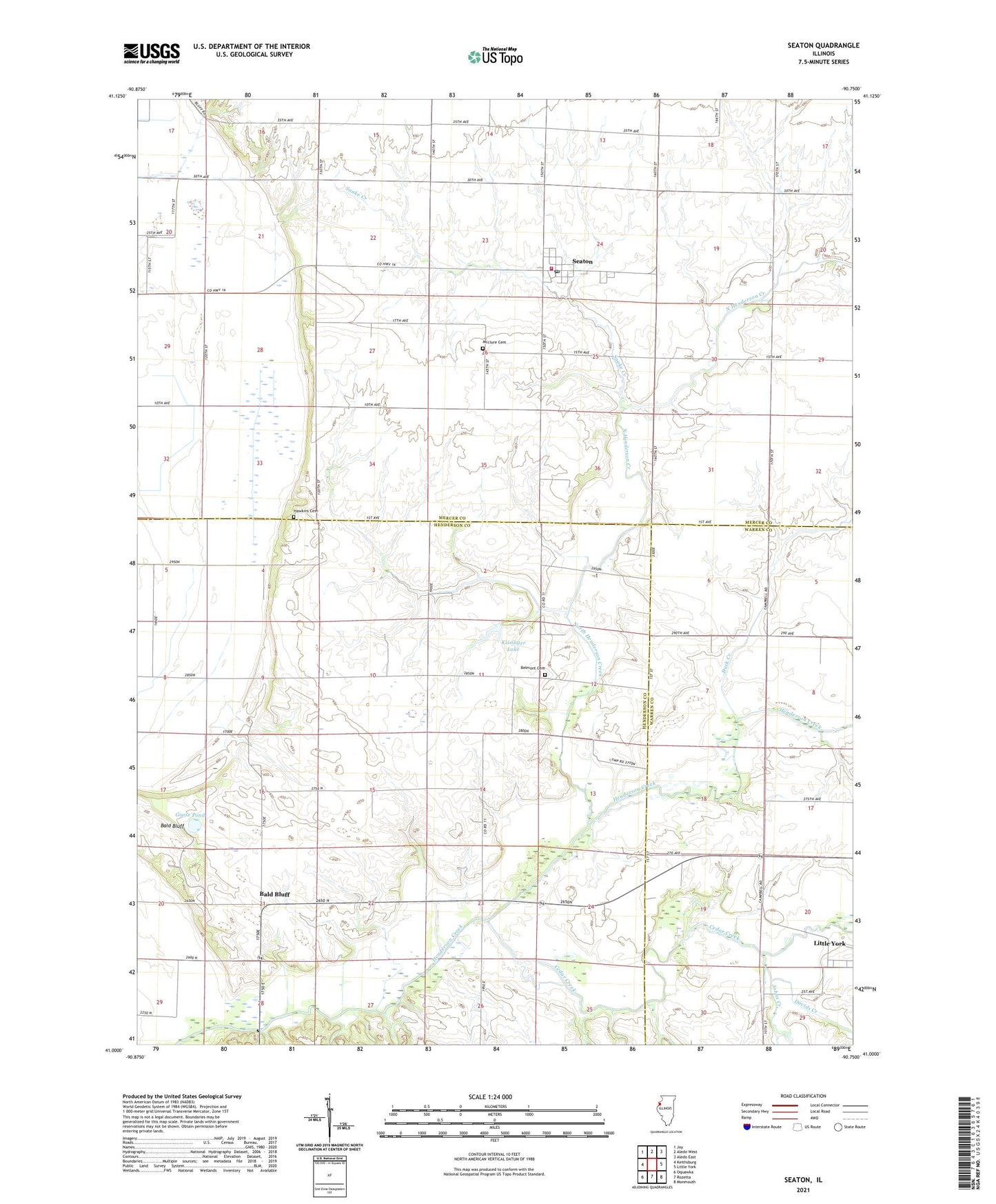
2024 topographic map quadrangle Seaton in the state of Illinois. Scale: 1:24000. Based on the newly updated USGS 7.5' US Topo map series, this map is in the following counties: Mercer, Henderson, Warren. The map contains contour data, water features, and other items you are used to seeing on USGS maps, but also has updated roads and other features. This is the next generation of topographic maps. Printed on high-quality waterproof paper with UV fade-resistant inks.
Quads adjacent to this one:
West: Keithsburg
Northwest: Joy
North: Aledo West
Northeast: Aledo East
East: Little York
Southeast: Monmouth
South: Rozetta
Southwest: Oquawka
This map covers the same area as the classic USGS quad with code o41090a7.
Contains the following named places: Abington Center School, Bald Bluff, Bald Bluff School, Belmont Cemetery, Belmont Church, Belmont School, Cedar Creek, Davids Creek, Douglas School, Duck Creek, Goose Pond, Hawkins Cemetery, Johns Creek, Kissinger Lake, Kissinger Lake Dam, Mcclure Cemetery, North Henderson Creek, Scaly Point School, Seaton, Seaton Community Fire Station, Seaton Post Office, Snake Creek, Township of Abington, Township of Bald Bluff, Village of Seaton, Walnut Grove School, ZIP Codes: 61453, 61476