MyTopo
Seward Illinois US Topo Map
Couldn't load pickup availability
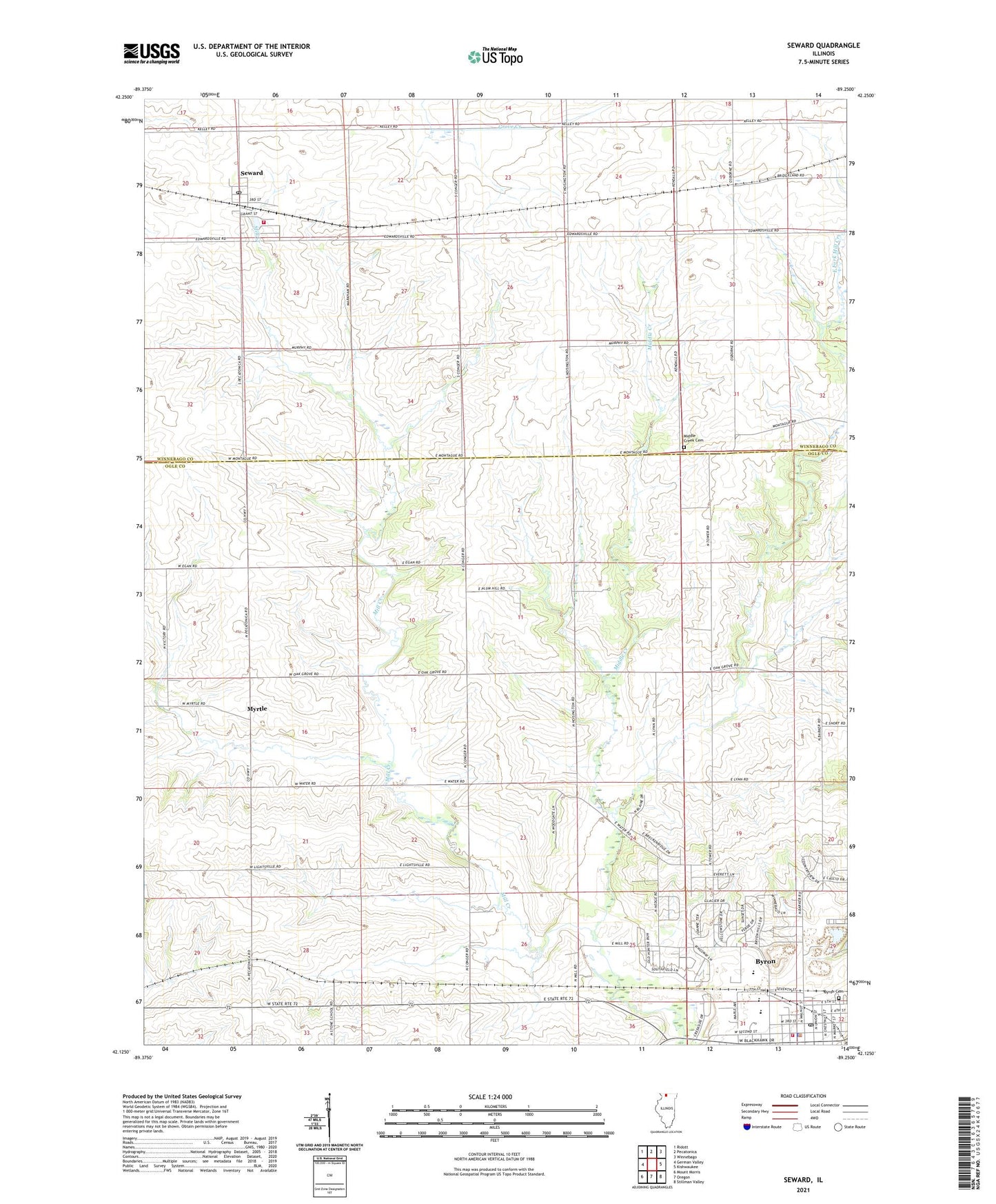
2024 topographic map quadrangle Seward in the state of Illinois. Scale: 1:24000. Based on the newly updated USGS 7.5' US Topo map series, this map is in the following counties: Ogle, Winnebago. The map contains contour data, water features, and other items you are used to seeing on USGS maps, but also has updated roads and other features. This is the next generation of topographic maps. Printed on high-quality waterproof paper with UV fade-resistant inks.
Quads adjacent to this one:
West: German Valley
Northwest: Ridott
North: Pecatonica
Northeast: Winnebago
East: Kishwaukee
Southeast: Stillman Valley
South: Oregon
Southwest: Mount Morris
This map covers the same area as the classic USGS quad with code o42089b3.
Contains the following named places: Asches Quarry, Burr Oak School, Byron, Byron Cemetery, Byron City Hall, Byron Fire Department, Byron High School, Byron Hills Estates, Byron Middle School, Byron Police Department, Byron Post Office, Byron Public Library, Byron Quarry, East Fork Mill Creek, Fairview School, First Baptist Church, Hogan School, Hoisington School, Mary Morgan Elementary School, Middle Creek, Middle Creek Cemetery, Middle Creek Presbyterian Church, Mill School, Moores Field, Mount Pleasant School, Myrtle, Myrtle School, Oak Grove School, Pecatonica Fire Protection District Station 2, Saint Marys Catholic Church, Saint Thomas Church, Seward, Seward Grade School, Seward Post Office, Township of Byron, Township of Seward, Union School, United Methodist Church of Byron, White School, ZIP Codes: 61010, 61077