MyTopo
Ridott Illinois US Topo Map
Couldn't load pickup availability
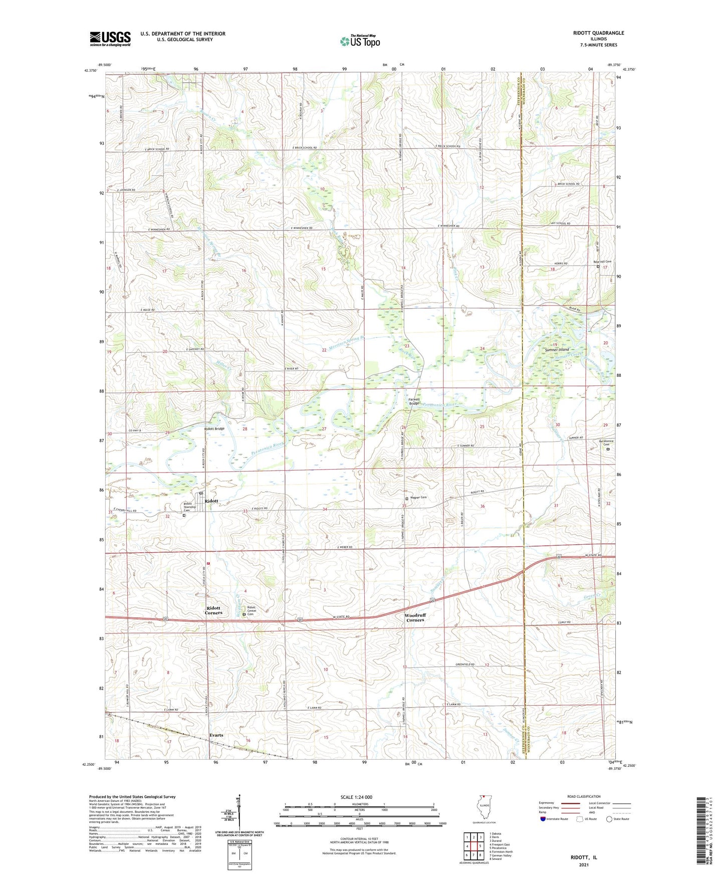
2024 topographic map quadrangle Ridott in the state of Illinois. Scale: 1:24000. Based on the newly updated USGS 7.5' US Topo map series, this map is in the following counties: Stephenson, Winnebago. The map contains contour data, water features, and other items you are used to seeing on USGS maps, but also has updated roads and other features. This is the next generation of topographic maps. Printed on high-quality waterproof paper with UV fade-resistant inks.
Quads adjacent to this one:
West: Freeport East
Northwest: Dakota
North: Davis
Northeast: Durand
East: Pecatonica
Southeast: Seward
South: German Valley
Southwest: Forreston North
This map covers the same area as the classic USGS quad with code o42089c4.
Contains the following named places: Avy School, Berlin School, Blake School, Bolen Quarry, Brown Creek, Cambier Airport, Centennial School, College School, Evarts, Everts International Airport, Farwell Bridge, German Valley Fire Protection District Station 2, Grove Creek, Hamilton School, Hunt Corners, Miller Creek, Morrison Spring Branch, North Ridott School, Pecatonica Cemetery, Pink Creek, Poplar Grove School, Ridott, Ridott Bridge, Ridott Center Cemetery, Ridott Center School, Ridott Corners, Ridott Post Office, Riverside School, Rock Run, Rose Hill Cemetery, Sumner Creek, Sumner Island, Township of Ridott, Village of Ridott, Wagner Cemetery, Wagner School, Wickham Creek, Winneshiek Creek, Woodruff Corners, ZIP Code: 61067