MyTopo
Spring Bay Illinois US Topo Map
Couldn't load pickup availability
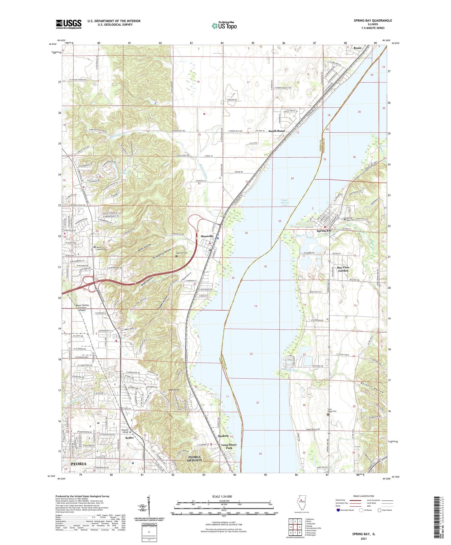
2024 topographic map quadrangle Spring Bay in the state of Illinois. Scale: 1:24000. Based on the newly updated USGS 7.5' US Topo map series, this map is in the following counties: Peoria, Woodford. The map contains contour data, water features, and other items you are used to seeing on USGS maps, but also has updated roads and other features. This is the next generation of topographic maps. Printed on high-quality waterproof paper with UV fade-resistant inks.
Quads adjacent to this one:
West: Dunlap
Northwest: Edelstein
North: Rome
Northeast: Chillicothe
East: Germantown Hills
Southeast: Washington
South: Peoria East
Southwest: Peoria West
This map covers the same area as the classic USGS quad with code o40089g5.
Contains the following named places: Anshai Emeth Synagogue, Ascension Lutheran Church, Averyville Baptist Church, Baha'i Faith, Bay View Garden, Bethany Baptist Church, Bielfeldt Park, Blalock Creek, Blue Creek, Bluff View School, Boyds Hollow, Boyland School, Burkett Hollow, Camp Wokanda Boy Scout Camp, Caterpillar - Mossville Fire Station, Cedar Bluff Estates, Charles A Lindbergh Middle School, Chillicothe Community Fire Department Station 5, City of Peoria, Detweiller Golf Course, Detweiller Park, Detweiller Woods Nature Preserve, Dickison Run, Dominion Square Shopping Center, Dunlap Fire Protection District Station 2, Elementary Tutoring Service Center, Exposition Gardens, Exposition Gardens Heliport, First Christian Church, First Church of God, First Church of the Nazarene, Forest Park Nature Center, Forest Park Nature Preserve, Forest Park South Nature Preserve, Frye School, Funks Run, Galena Road Baptist Church, Gardner School, Gaylord Wildlife Area, Grace and Peace Lutheran Church, Health Academy, Hickory Grove Park, High Point, Hillside School, Illinois Central College, Illinois River State Fish and Wildlife Area, Immanuel Lutheran Church, Jerry E Staab Airport, Junction City Shopping Center, Kellar Primary School, Keller, Keller School, Lake of the Woods, Lake of the Woods Dam, Lake of the Woods Plaza Shopping Center, Leo Donovan Golf Course, Lifepath School of Massage Therapy, Lindbergh Park, Little Friends Learning Center, Long Shore Park, Medina Township Police Department, Midstate College, Moon Hollow, Mossville, Mossville Census Designated Place, Mossville Church, Mossville Elementary School, Mossville Post Office, Mount Hawley Auxiliary Airport, Mount Hawley Cemetery, Mount Hawley Country Club, Mount Hawley Park, Mount Olive Missionary Church, Norhtmoor Primary School, North Memorial Baptist Church, North University Post Office, Northminster Presbyterian Church, Northmoor Municipal Golf Course, Northpark Baptist Church, Northport Shopping Plaza Shopping Center, Northwood Community Church, Olivet Church, P S Academy of Martial Arts, Peoria Developmental Center, Peoria Fire Department Station 15, Peoria Fire Department Station 20, Peoria Fire Training Academy, Peoria Heights Volunteer Fire Department Station 2, Peoria Recovery Center, Pioneer Square Shopping Center, Poppet Hollow, Powley Gravel Pit, Proctor Community Hospital Heliport, Proctor Hospital, Prospect Park, Richwoods Community High School, Riverside School, Riverview Elementary School, Robert Rutherford Wildlife Sanctuary, Robinson Cemetery, Robinson Park, Robinson Park Hill Prairies Nature Preserve, Rolling Acres Middle School, Saint Judes Church, Saint Vincent de Paul School, Salvation Army Camp, Sand Ridge Cemetery, Sankoty, Second Church of Christ, Singing Woods Nature Preserve, South Rome, Spring Bay, Spring Bay Cemetery, Spring Bay Fen Nature Preserve, Spring Bay Fire Protection District Station 1, Spring Bay Township Hall, Strawberry Hollow, Tanglewood Shopping Cente, Township of Medina, Township of Richwoods, Township of Spring Bay, Village of Bay View Gardens, Village of Spring Bay, Willow Knolls Country Club, Windsor Square Shopping Center, Woodford County State Conservation Area, Woods Park, Zeller Mental Health Center, ZIP Codes: 61552, 61614


