MyTopo
Germantown Hills Illinois US Topo Map
Couldn't load pickup availability
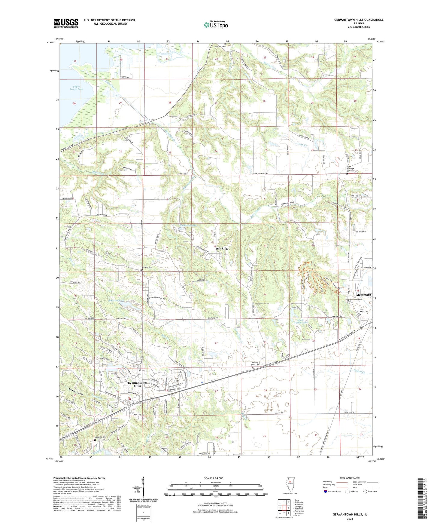
2024 topographic map quadrangle Germantown Hills in the state of Illinois. Scale: 1:24000. Based on the newly updated USGS 7.5' US Topo map series, this map is in the following counties: Woodford, Peoria. The map contains contour data, water features, and other items you are used to seeing on USGS maps, but also has updated roads and other features. This is the next generation of topographic maps. Printed on high-quality waterproof paper with UV fade-resistant inks.
Quads adjacent to this one:
West: Spring Bay
Northwest: Rome
North: Chillicothe
Northeast: Washburn
East: Metamora
Southeast: Eureka
South: Washington
Southwest: Peoria East
This map covers the same area as the classic USGS quad with code o40089g4.
Contains the following named places: Alcott School, Black Partridge Cemetery, Camp Tapawingo, Camp Wildwood, Christ Church, Christian Union Church, Faith Bible Church, Germantown Hills, Germantown Hills Baptist Church, Germantown Hills Community Center, Germantown Hills Elementary School, Germantown Hills Fire Protection District, Germantown Hills Middle School, Germantown Hills Town Hall, Haedicke Cemetery, Hickory Point, Hickory Point Cemetery, Hickory Point School, Illinois State Police Department District 8, Izaak Walton Lake, Izaak Walton Lake Dam, John D Rennick Airport, Lake Santa Fe, Lake Santa Fe Dam, Lone Hill Cemetery, Lourdes Church, Mount Alerno Novitiate, Mundinger Creek, Oak Ridge, Oakenwald School, Oakhill School, Oakwood Cemetery, Partridge Creek, Partridge School, Pleasant View School, Prairie Lake School, Saint Mary's Cemetery, Township of Worth, Tuckaway Manor Mobile Home Park, Village of Germantown Hills, WBZM-FM (Chillicothe), Wernsmans Airport, Wildwind Lake, Willow Hill Church, Winkler Cemetery, ZIP Code: 61548