MyTopo
Walsh Illinois US Topo Map
Couldn't load pickup availability
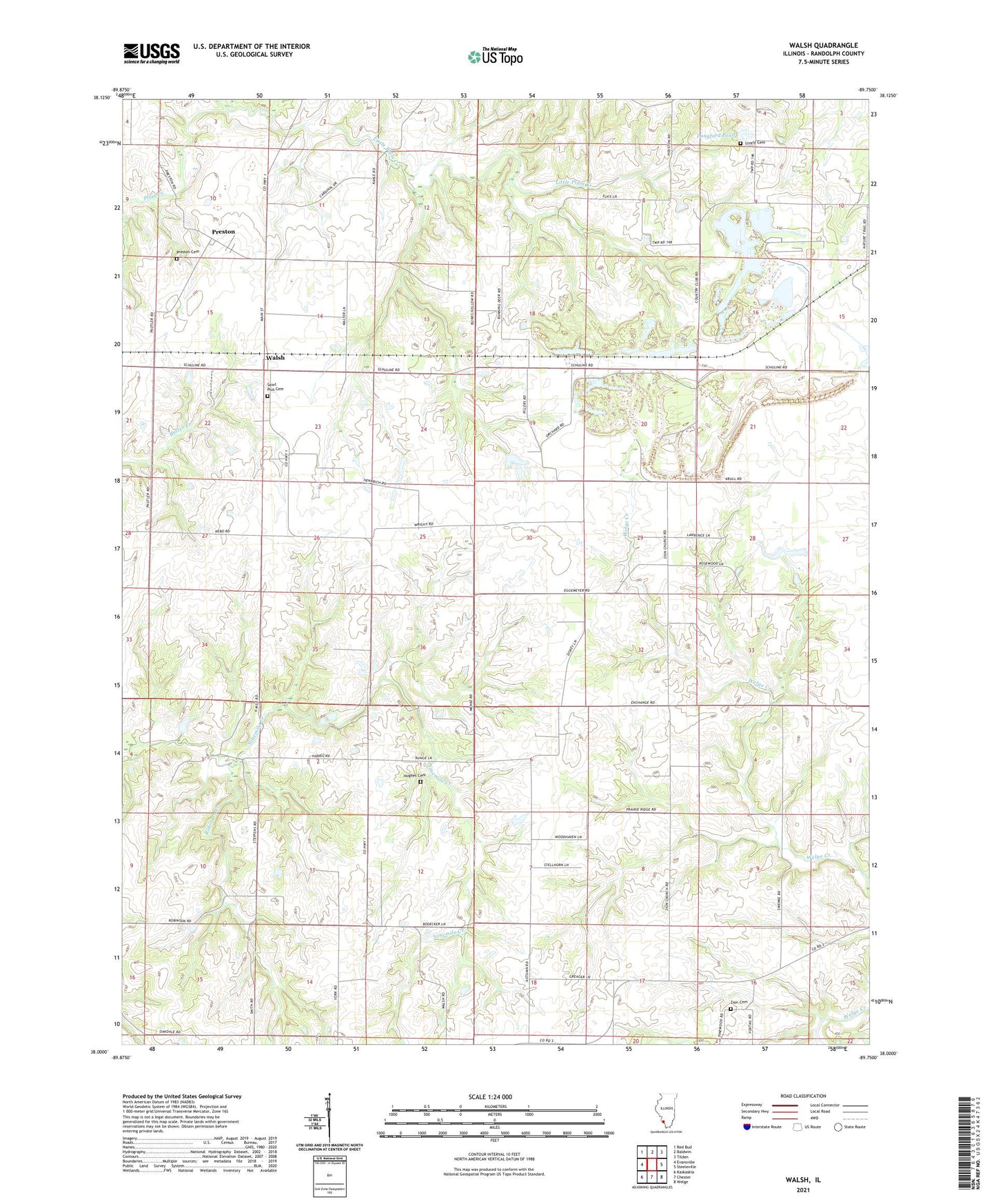
2024 topographic map quadrangle Walsh in the state of Illinois. Scale: 1:24000. Based on the newly updated USGS 7.5' US Topo map series, this map is in the following counties: Randolph. The map contains contour data, water features, and other items you are used to seeing on USGS maps, but also has updated roads and other features. This is the next generation of topographic maps. Printed on high-quality waterproof paper with UV fade-resistant inks.
Quads adjacent to this one:
West: Evansville
Northwest: Red Bud
North: Baldwin
Northeast: Tilden
East: Steeleville
Southeast: Welge
South: Chester
Southwest: Kaskaskia
This map covers the same area as the classic USGS quad with code o38089a7.
Contains the following named places: Central Attendence Center, Central Election Precinct, Charter Oak School, Hiawassie School, Hughes Cemetery, Korando Airport, Langford Pond, Langford Pond Dam, Lebanon School, Little Plum Creek, Lively Cemetery, Oak Grove School, Oakdale School, Olive School, Palestine Election Precinct, Perry Ridge School, Preston, Preston Cemetery, Randolph County, Robinson Creek, Saint Pius Cemetery, Schuline, Walsh, Walsh Election Precinct, Zion Cemetery, Zion Church, ZIP Code: 62297