MyTopo
Welge Illinois US Topo Map
Couldn't load pickup availability
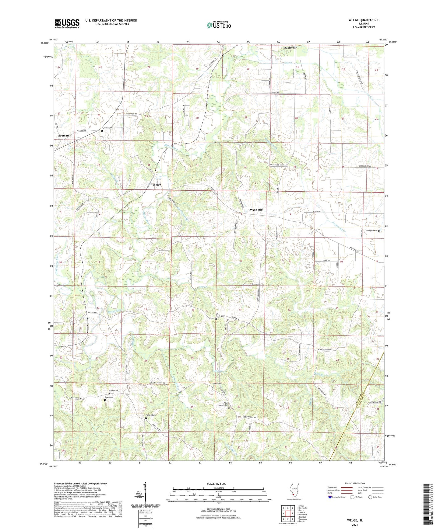
2024 topographic map quadrangle Welge in the state of Illinois. Scale: 1:24000. Based on the newly updated USGS 7.5' US Topo map series, this map is in the following counties: Randolph, Jackson. The map contains contour data, water features, and other items you are used to seeing on USGS maps, but also has updated roads and other features. This is the next generation of topographic maps. Printed on high-quality waterproof paper with UV fade-resistant inks.
Quads adjacent to this one:
West: Chester
Northwest: Walsh
North: Steeleville
Northeast: Percy
East: Willisville
Southeast: Raddle
South: Rockwood
Southwest: Belgique
This map covers the same area as the classic USGS quad with code o37089h6.
Contains the following named places: Bremen, Bremen Election Precinct, Cox Creek, Crescent Club Lake, Crescent Club Lake Dam, Draves Cemetery, Dry Creek, Emery Cemetery, Frickes Branch, Fulford Cemetery, Gillespie Cemetery, Grah Cemetery, Hornbostel Branch, Leanderville, Little Marys River, Little Mill Creek, Maple Hill School, Mill Creek, Mill Creek Cemetery, Mill Creek School, Mount Summit Cemetery, Mount Summit School, North Fork Cox Creek, Oak School, Paradise Cemetery, Piney Branch, Piney Creek Ravine Nature Preserve, Poland, Randolph, Rockcastle Creek, Saint Johns Church, Saint Peters Church, Simon School, Springvale School, Steele School, Welge, Wine Hill, Wine Hill Election Precinct, ZIP Code: 62288