MyTopo
Weldon West Illinois US Topo Map
Couldn't load pickup availability
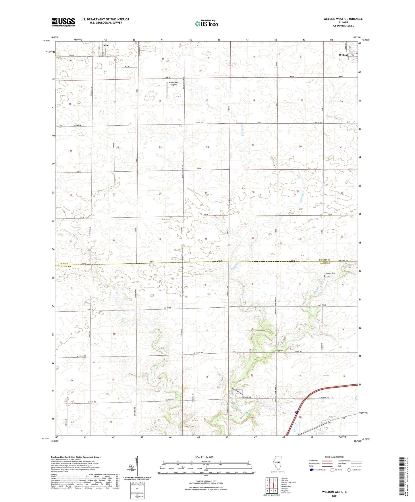
2024 topographic map quadrangle Weldon West in the state of Illinois. Scale: 1:24000. Based on the newly updated USGS 7.5' US Topo map series, this map is in the following counties: De Witt, Macon. The map contains contour data, water features, and other items you are used to seeing on USGS maps, but also has updated roads and other features. This is the next generation of topographic maps. Printed on high-quality waterproof paper with UV fade-resistant inks.
Quads adjacent to this one:
West: Maroa
Northwest: Clinton
North: De Witt
Northeast: Farmer City South
East: Weldon East
Southeast: Cerro Gordo
South: Argenta
Southwest: Forsyth
This map covers the same area as the classic USGS quad with code o40088a7.
Contains the following named places: Bakers Strip Airport, Central School, Chandler Cemetery, Cox School, Friends Creek County Park, Lane, Lane Census Designated Place, Long Cemetery, Martin RLA Airport, Shiloh Chapel, Township of Creek, Township of Friends Creek, Township of Nixon, Weldon Community Fire Protection District, Weldon Post Office, ZIP Codes: 61750, 61882