MyTopo
Weldon East Illinois US Topo Map
Couldn't load pickup availability
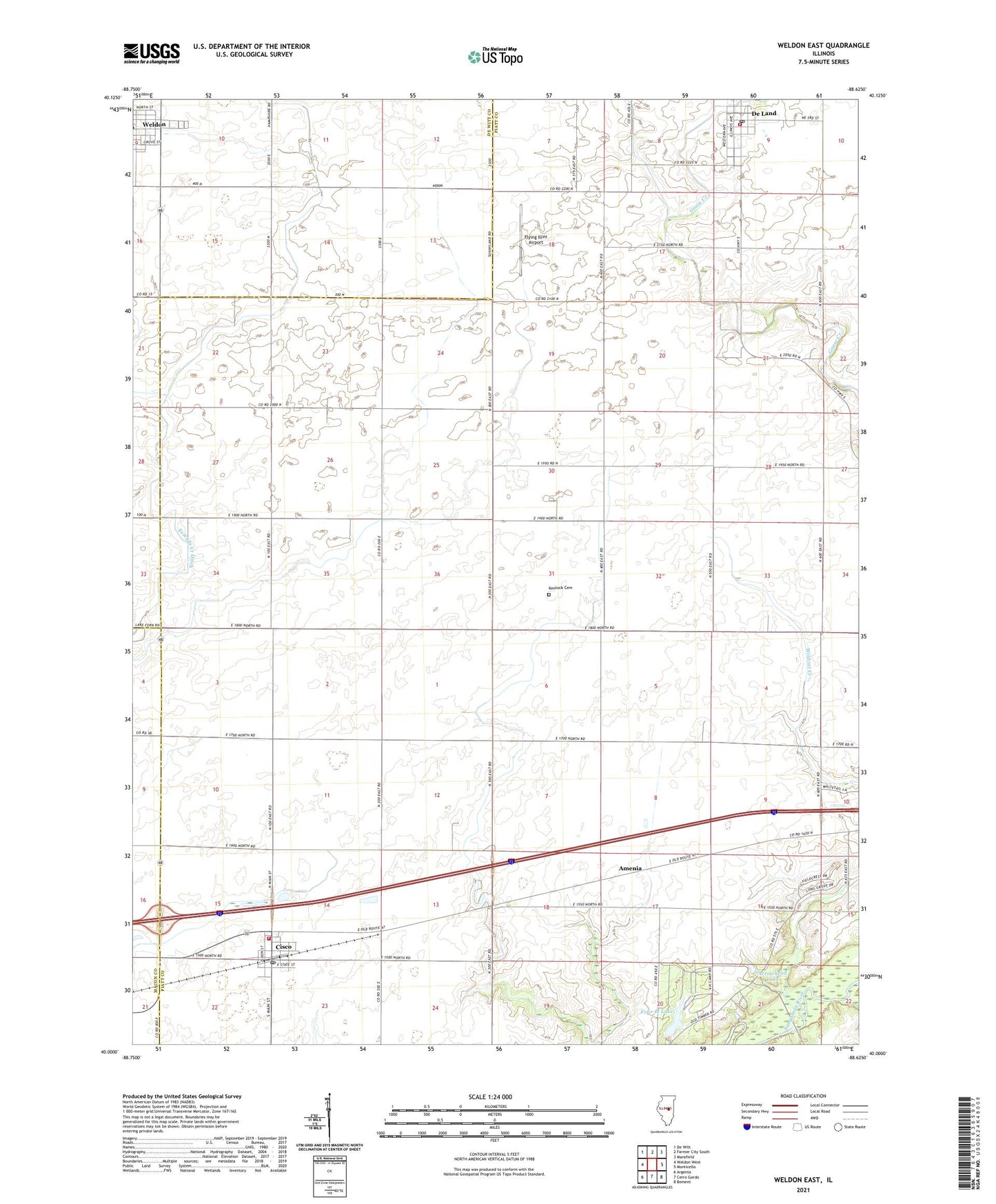
2024 topographic map quadrangle Weldon East in the state of Illinois. Scale: 1:24000. Based on the newly updated USGS 7.5' US Topo map series, this map is in the following counties: Piatt, De Witt, Macon. The map contains contour data, water features, and other items you are used to seeing on USGS maps, but also has updated roads and other features. This is the next generation of topographic maps. Printed on high-quality waterproof paper with UV fade-resistant inks.
Quads adjacent to this one:
West: Weldon West
Northwest: De Witt
North: Farmer City South
Northeast: Mansfield
East: Monticello
Southeast: Bement
South: Cerro Gordo
Southwest: Argenta
This map covers the same area as the classic USGS quad with code o40088a6.
Contains the following named places: Allerton State Park, Amenia, Arrowhead Lake, Ashland School, Cisco, Cisco Fire Protection District, Cisco Post Office, De Land, De Land Community Fire Protection District, De Land Post Office, East Cisco School, Enterprise School, Excelsior School, Flying Illini Airport, Four H Memorial Lake Dam, Four-H Lake, Friends Creek Ditch, Kentuck Cemetery, Kentucky Church, Kentucky School, Lincoln School, Morain School, New Union School, Norfleet Farms Airport, Pleasant Falls School, Pleasant Ridge School, Prairie View School, Prospect School, Township of Goose Creek, Village of Cisco, Village of De Land, Village of Weldon, Weldon, Wildcat Creek, Wildcat School, WILL-FM (Urbana), WILL-TV (Urbana), ZIP Code: 61830