MyTopo
Woodworth Illinois US Topo Map
Couldn't load pickup availability
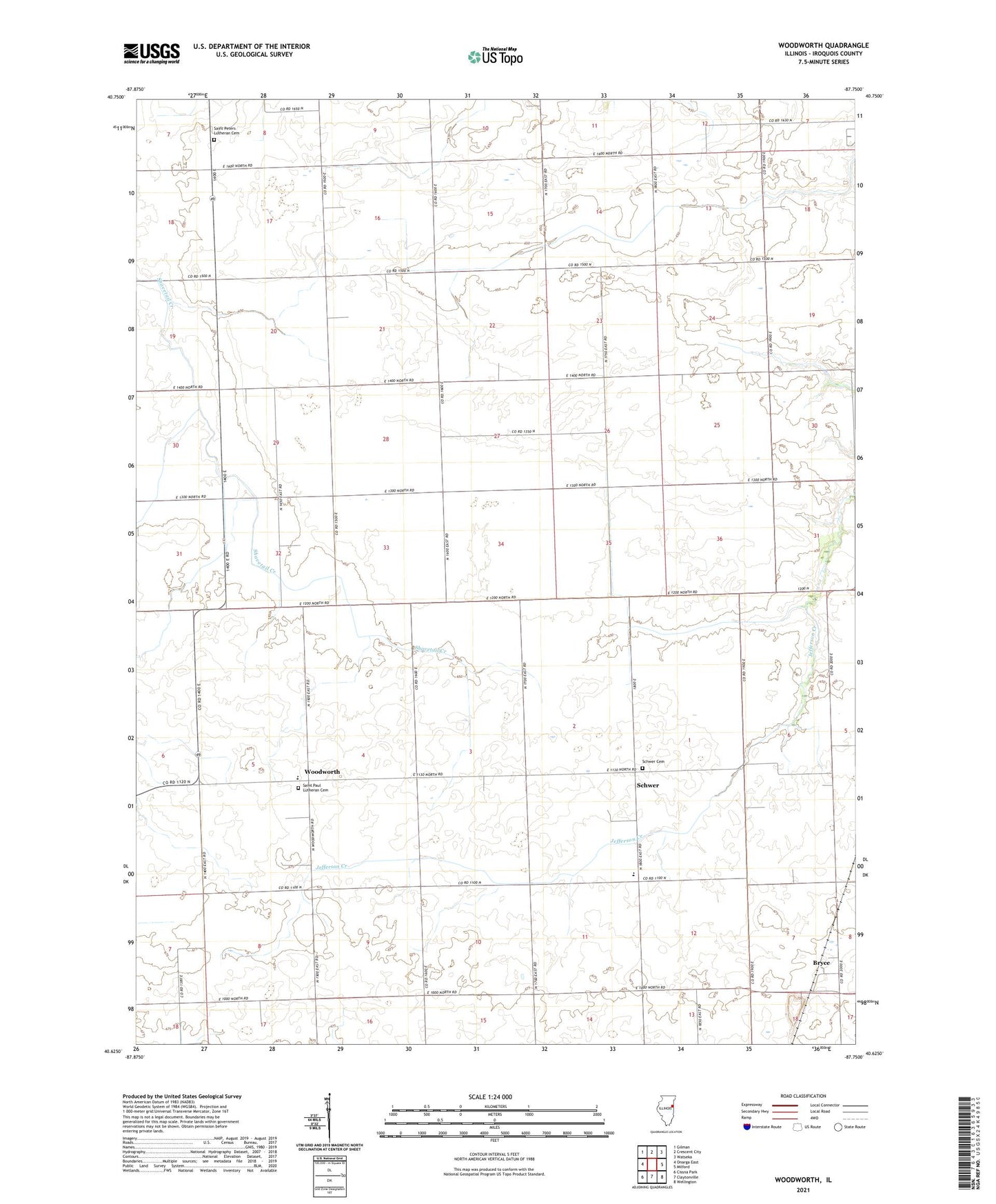
2024 topographic map quadrangle Woodworth in the state of Illinois. Scale: 1:24000. Based on the newly updated USGS 7.5' US Topo map series, this map is in the following counties: Iroquois. The map contains contour data, water features, and other items you are used to seeing on USGS maps, but also has updated roads and other features. This is the next generation of topographic maps. Printed on high-quality waterproof paper with UV fade-resistant inks.
Quads adjacent to this one:
West: Onarga East
Northwest: Gilman
North: Crescent City
Northeast: Watseka
East: Milford
Southeast: Wellington
South: Claytonville
Southwest: Cissna Park
This map covers the same area as the classic USGS quad with code o40087f7.
Contains the following named places: Ahlden Farms, Barritt School, Blue Grove School, Bryce, Carley Farms, Clifton School, Frerichs Farm, Gilchrist School, Hopkins Farm, Iroquois County, Kelly School, Miner Farm, Pleasant Hill School, Pleasant Knoll Farm, Rapp Farm, Redeker Airport, Rush School, Saint Paul Lutheran Cemetery, Saint Paul School, Saint Peters Lutheran Cemetery, Schippert Farms, Schwer, Schwer Cemetery, Search School, Township of Ash Grove, Township of Crescent, Van Hoveln Farms, Woodworth, Zecher Farm, ZIP Code: 60928