MyTopo
Crescent City Illinois US Topo Map
Couldn't load pickup availability
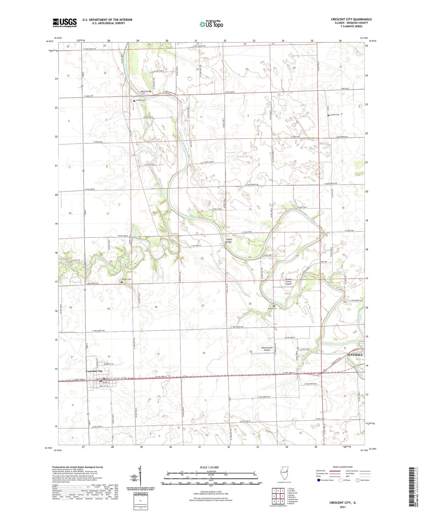
2024 topographic map quadrangle Crescent City in the state of Illinois. Scale: 1:24000. Based on the newly updated USGS 7.5' US Topo map series, this map is in the following counties: Iroquois. The map contains contour data, water features, and other items you are used to seeing on USGS maps, but also has updated roads and other features. This is the next generation of topographic maps. Printed on high-quality waterproof paper with UV fade-resistant inks.
Quads adjacent to this one:
West: Gilman
Northwest: Clifton
Northeast: Beaverville
East: Watseka
Southeast: Milford
South: Woodworth
Southwest: Onarga East
This map covers the same area as the classic USGS quad with code o40087g7.
Contains the following named places: Braden Farms Airport, Cleveland School, Columbia School, Crescent - Iroquois Emergency Medical Services and Ambulance Services, Crescent - Iroquois Fire Protection District, Crescent City, Crescent City Elementary School, Crescent City Post Office, Crescent City Station, Crescent-Iroquois High School, Dietchweiler Airport, Fiddler Bridge, Flesher Cemetery, Hi Ho Farm, Liberty Loan School, Loveridge School, Lyman Cemetery, Lyman School, Pierce Cemetery, Plato Bridge, Plato Post Office, Plato School, Prairie View School, Schoon School, Spring Creek, Sugar Creek, Township of Iroquois, Village of Crescent City, Washington School, Wessels Farms, WGFA-AM (Watseka), WGFA-FM (Watseka), Wilson Cemetery, Yates Farm