MyTopo
La Fontaine Indiana US Topo Map
Couldn't load pickup availability
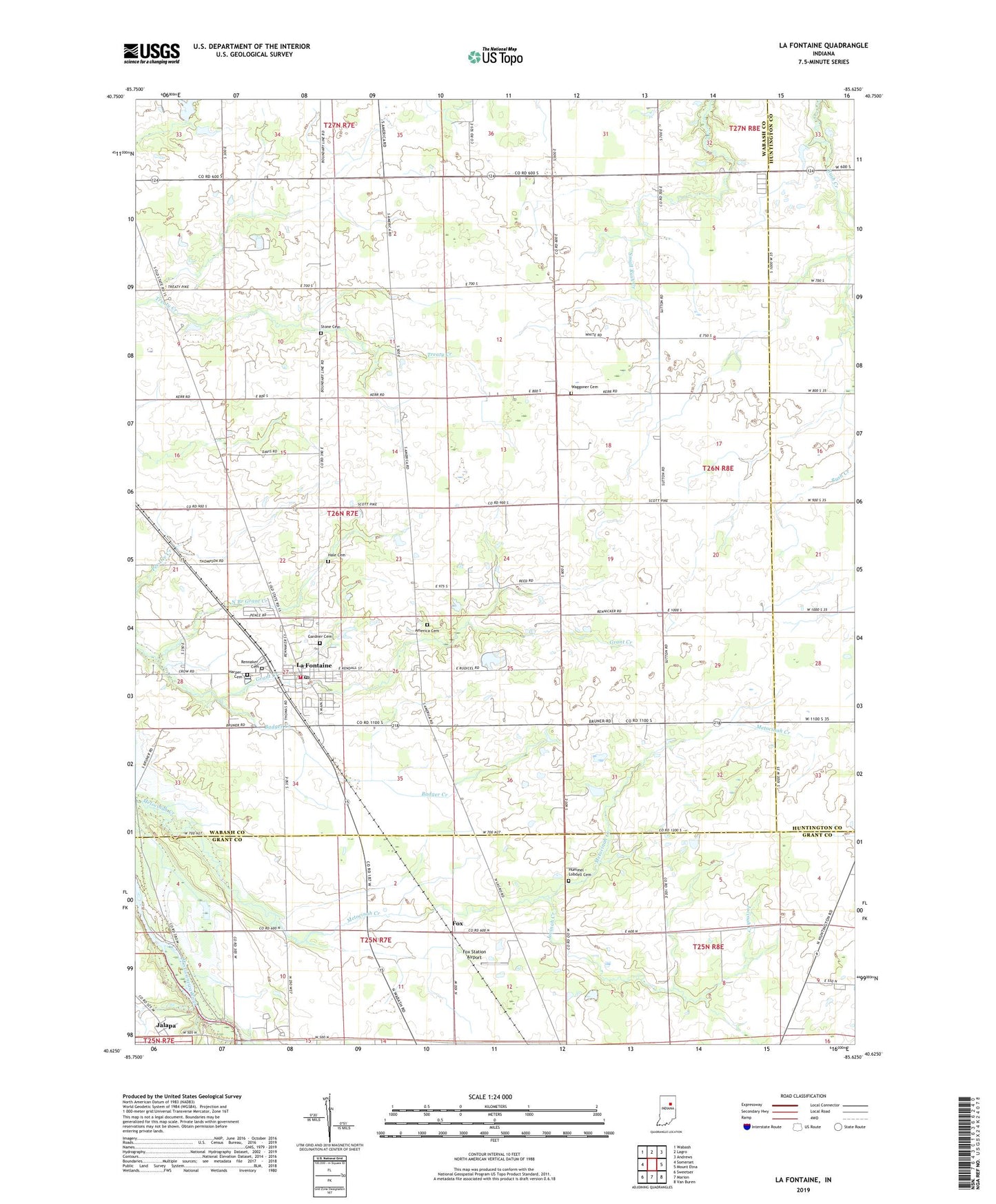
2022 topographic map quadrangle La Fontaine in the state of Indiana. Scale: 1:24000. Based on the newly updated USGS 7.5' US Topo map series, this map is in the following counties: Wabash, Grant, Huntington. The map contains contour data, water features, and other items you are used to seeing on USGS maps, but also has updated roads and other features. This is the next generation of topographic maps. Printed on high-quality waterproof paper with UV fade-resistant inks.
Quads adjacent to this one:
West: Somerset
Northwest: Wabash
North: Lagro
Northeast: Andrews
East: Mount Etna
Southeast: Van Buren
South: Marion
Southwest: Sweetser
This map covers the same area as the classic USGS quad with code o40085f6.
Contains the following named places: America, America Cemetery, Badger Creek, Boundary Line Church, Fox, Fox Station Airport, Gardner Cemetery, Hale Cemetery, Harper Cemetery, Hummel - Lobdell Cemetery, Jalapa, Jalapa Census Designated Place, Jocinah Creek, La Fontaine, La Fontaine - Liberty Township Fire Department, La Fontaine Post Office, La Fontaine Town Marshal Office, Lafontaine Elementary School, Miami Indian Cemetery, North Branch Grant Creek, Rennaker Cemetery, Stone Cemetery, Town of La Fontaine, Township of Liberty, Waggoner Cemetery, ZIP Code: 46940