MyTopo
Ashton Iowa US Topo Map
Couldn't load pickup availability
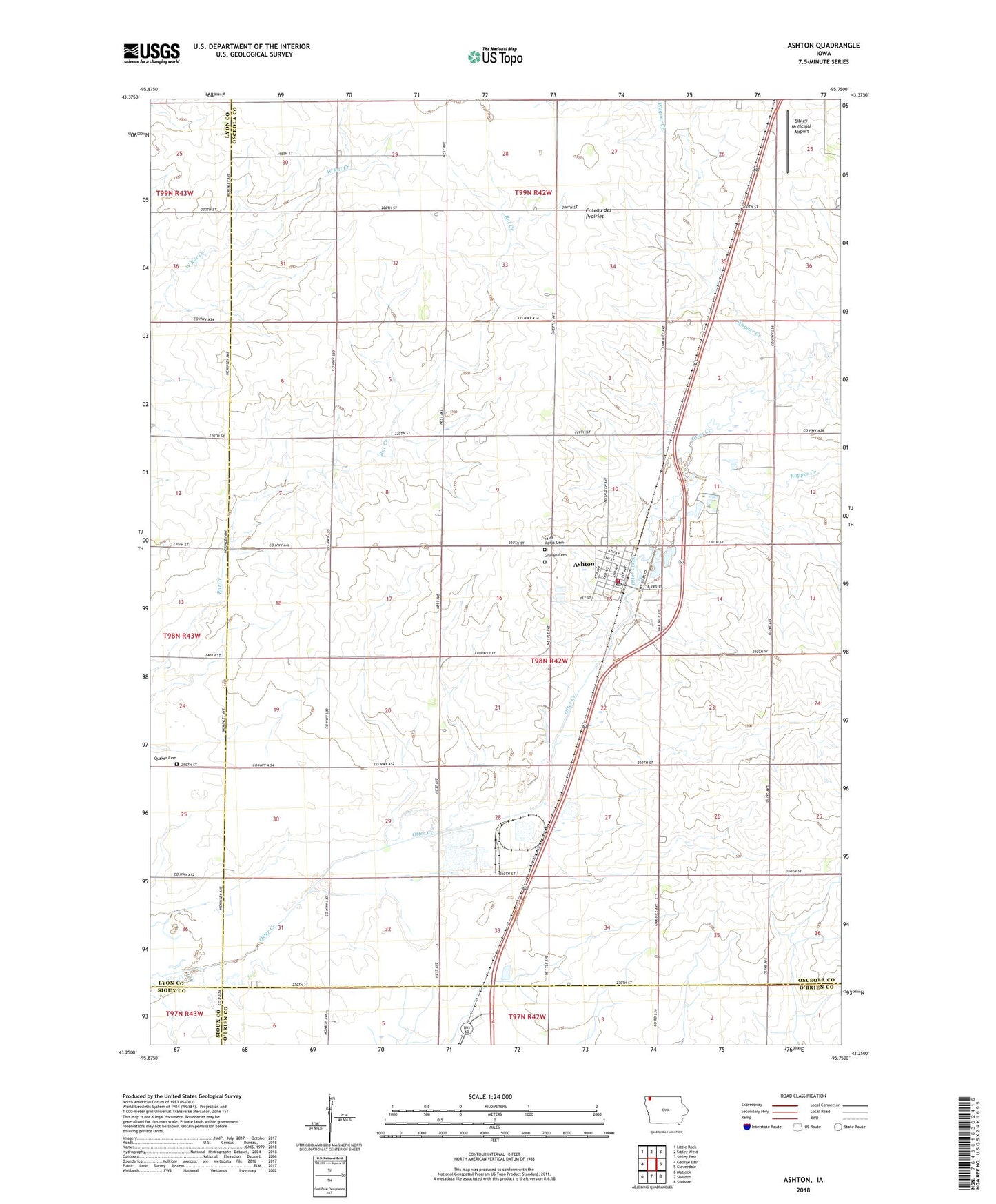
2022 topographic map quadrangle Ashton in the state of Iowa. Scale: 1:24000. Based on the newly updated USGS 7.5' US Topo map series, this map is in the following counties: Osceola, Lyon, O'Brien, Sioux. The map contains contour data, water features, and other items you are used to seeing on USGS maps, but also has updated roads and other features. This is the next generation of topographic maps. Printed on high-quality waterproof paper with UV fade-resistant inks.
Quads adjacent to this one:
West: George East
Northwest: Little Rock
North: Sibley West
Northeast: Sibley East
East: Cloverdale
Southeast: Sanborn
South: Sheldon
Southwest: Matlock
This map covers the same area as the classic USGS quad with code o43095c7.
Contains the following named places: Ashton, Ashton Bible Church, Ashton Fire Department, Ashton Park, Ashton Pits State Public Hunting Area, Ashton Post Office, Ashton Public Library, City of Ashton, D and J Farm, Gilman Cemetery, Kappes Creek, Luitjens Farms, Northwest Iowa Cooperative Elevator, Osceola County Ambulance Service Ashton Division, Our Lady of Perpetual Help Church, Pair - A - Dice Ranch, Presbyterian Church, Quaker Cemetery, Saint Marys Cemetery, Sibley Dairy, Sibley Municipal Airport, Strouth Wildlife Management Area, Township of Gilman, Wagner Creek, Wheeler Wildlife Refuge, Zylstra Feedlot, ZIP Code: 51232