MyTopo
George East Iowa US Topo Map
Couldn't load pickup availability
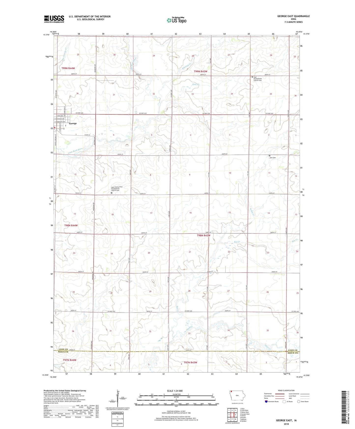
2022 topographic map quadrangle George East in the state of Iowa. Scale: 1:24000. Based on the newly updated USGS 7.5' US Topo map series, this map is in the following counties: Lyon, Sioux. The map contains contour data, water features, and other items you are used to seeing on USGS maps, but also has updated roads and other features. This is the next generation of topographic maps. Printed on high-quality waterproof paper with UV fade-resistant inks.
Quads adjacent to this one:
West: George West
Northwest: Edna
North: Little Rock
Northeast: Sibley West
East: Ashton
Southeast: Sheldon
South: Matlock
Southwest: Boyden
This map covers the same area as the classic USGS quad with code o43095c8.
Contains the following named places: Dale Townhall, De Groot Farms, Dream Street Farms, Ebenezer Presbyterian Church, First Baptist Church, First Presbyterian Church, George - Little Rock Elementary School, George - Little Rock High School, George Community Good Samaritan Hospital, George Emergency Medical Services, George Fire Department, Grant Townhall, Immanuel Lutheran Church, L and E Farms, Little Rock River Wildlife Area - Central Unit, Lyon County First Presbyterian Church Cemetery, Rat Creek, Schrick Farms, Sudenga Industries Landing Field, Tabernacle Baptist Church, Township of Dale, West Rat Creek, Whitney Creek, Zion Lutheran Cemetery, Zoar Church, Zoar Creek, Zoar Presbyterian Church Cemetery